koo-koo for Cucamonga

TRs for the San Gabriel Mountains.
Post Reply
User avatar
Elwood
Posts: 612
Joined: Fri Aug 15, 2008 5:23 pm

Post by Elwood »

I decided to take a little stroll from the closed San Sevaine Road (1N34) gate on Lytle Creek Road up towards Cucamonga Peak this past Saturday. Visibility below 5000' was a meager 100' in the morning. The view south over the IE and SG valley was a sea of clouds all day. I turned around at 1330 PDT, about 1.72 trail miles from the summit, in order not to anger the marriage g-ds with a late return to Simi Valley. The views down the middle fork of Lytle Creek, the ridge of the 'Ts' and of Cucamonga herself were great and not too hazy. The Joe Elliot campground itself is trippy. Cut timber everywhere. I can only imagine what this looked like before all these trees were burned and/or cut down. Do any forum members know the history of this CG? When it last burned?

The hike itself is just a (long) slog up 1N34, mercifully all dirt, then down to the campground. It passes a branch to a lookout and microwave relay site. Upon entering the Cucamonga wilderness at the end of the CG, the trail gently climbs and contours towards the peak. There is one pair of switchbacks at around 7200' that is overgrown and crossed with deadfalls. The yellow trail flares were more useful than annoying here. I bypassed this entirely on the way down, following the adjacent ridge through minor buckthorn. There were some interesting artifacts on the ridge including a rusted-out riveted water heater tank.

I was on the hoof at 0600, and back at the jeep at 1850. Had I been able to see the endless switching back of San Savaine road in the morning, I might have thought better of starting this hike.

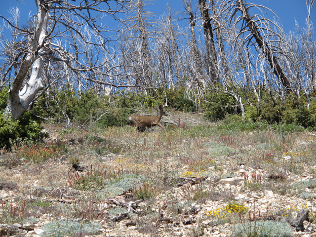
This Young Mule Deer Stag (Odocoileus hemionus) was just above the "Big Tree" Camprground:

Image

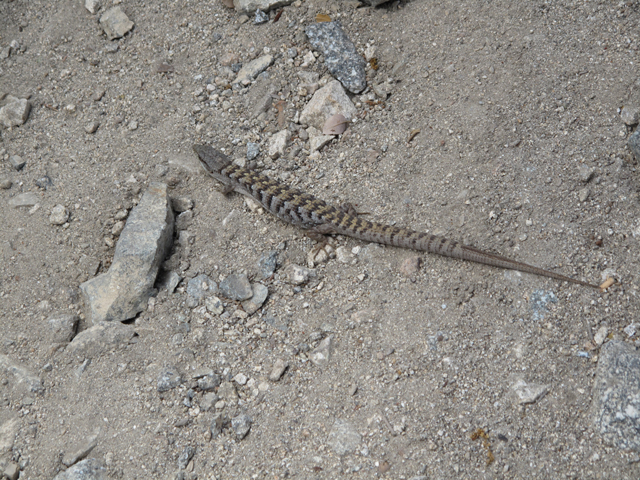
An Alligator Lizard (Elgaria multicarinata multicarinata) on 1N34:

Image

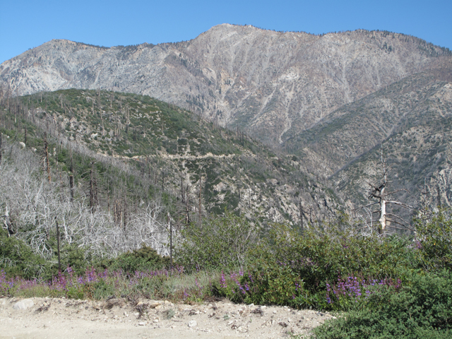
Cucamonga peak from 1N34, before descending to Joe Elliot.

Image

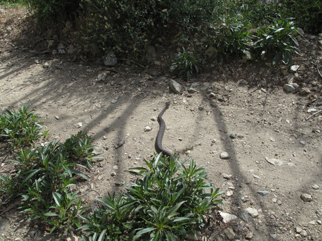
Another beautiful Rattlesnake (Croatlus Oreganus Helleri) that was relaxing under the foliage mid-road. It slithered off when I turned towards it to take this picture, no rattling:

Image

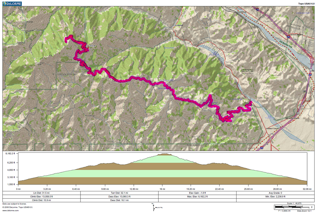
A fuzzy jpeg of the pdf of my track for the day:

Image
User avatar
Taco
Snownado survivor
Posts: 6011
Joined: Thu Sep 27, 2007 4:35 pm

Post by Taco »

Cool photos. Alligator Lizard = Skink?
User avatar
Hikin_Jim
Posts: 4686
Joined: Thu Sep 27, 2007 9:04 pm

Post by Hikin_Jim »

Nice pix. Seldom visited country over there except maybe by the Hundred Peaks Section en route to Buck Point. Most folks do Cuca & Eti from Icehouse Can. Not too surprised to hear trail from the east not in good shape.
User avatar
EnFuego
Posts: 677
Joined: Mon Dec 15, 2008 11:14 am

Post by EnFuego »

Now that looks like a long day. nice job and cool pics on the animals.
User avatar
RichardK
Posts: 727
Joined: Sun Sep 30, 2007 12:33 pm

Post by RichardK »

Thanks for posting a report on a seldom visited area. Nice pictures.
User avatar
mattmaxon
Posts: 1137
Joined: Mon Mar 24, 2008 12:48 pm

Post by mattmaxon »

I was thinking of doing Cucamonga Peak from Ice House Cyn exiting over to San Savine road out to Lytel Creek Rd

Return on my MC to IHC TH

would it be possible to get a GPX of your trip?

Thanks
Matt

BTW I saw your vehicle at the gate... I stopped to see if my ANF gate key would work...Bah no luck
User avatar
Elwood
Posts: 612
Joined: Fri Aug 15, 2008 5:23 pm

Post by Elwood »

Regarding Alligator Lizards and Skinks: I've never had any luck photographing local Skinks (Plestiodon"gilberti" rubricaudatus and relatives) although others here have. I saw one last week on the Stone Canyon trail up to Mt. Lukens. Skinks are typically smaller and more streamlined than Alligator Lizards. Oh yeah, and faster.


GPX of this track, hope the embedded periods don't confuse...
User avatar
Mike P
Posts: 1005
Joined: Tue Oct 02, 2007 10:48 pm

Post by Mike P »

Thanks, Elwood. This trip is on my short list.
Post Reply