Waterman Mtn Trail 5/29/09

TRs for the San Gabriel Mountains.
Post Reply
User avatar
mattmaxon
Posts: 1137
Joined: Mon Mar 24, 2008 12:48 pm

Post by mattmaxon »

Finally got off my sorry butt and cleared those down trees on the waterman mtn trail on Friday 5/29


Image

Image

Also went and had a look at the swimming hole below Buckhorn Cpgd

Could be useful as a warm weather canyoneering training, & practice spot...

Image
User avatar
EnFuego
Posts: 677
Joined: Mon Dec 15, 2008 11:14 am

Post by EnFuego »

Wow. Nice work.

And you're right, that would be a nice location for training.
User avatar
cougarmagic
Posts: 1409
Joined: Wed May 07, 2008 5:21 pm

Post by cougarmagic »

Well done! Thanks, that trail needed that!
User avatar
MtnMan
Posts: 143
Joined: Fri May 08, 2009 2:22 am

Post by MtnMan »

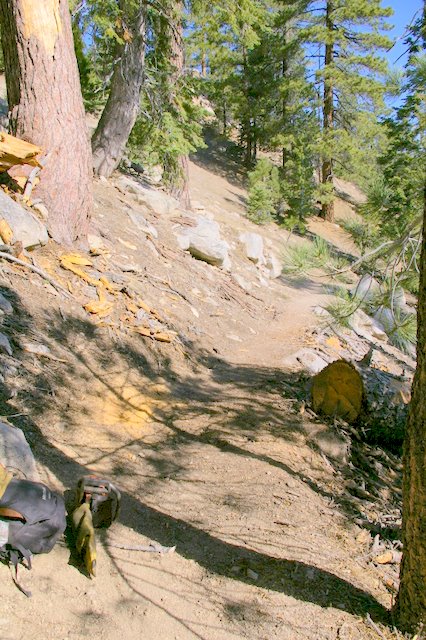
Thanks for clearing the downed trees... Although, usually if you report them to a USFS office, with details, (location, diameter of tree/s, etc) they often get a fire crew/certified volunteer to hike in and buck it up.

Those guys (fire crews) generally enjoy doing that kind of work, and is actually a part of their pre-season conditioning training for most stations, and depend on these types of projects.
User avatar
mattmaxon
Posts: 1137
Joined: Mon Mar 24, 2008 12:48 pm

Post by mattmaxon »

MtnMan wrote:Thanks for clearing the downed trees... Although, usually /certified volunteer to hike in and buck it up.
Yeah well since I am a certified volunteer (class B faller) and have well over 25+ years experience in these matters

I'd say I am qualified, but thanks for your concern

If they want to do some more down trees there are 5 down trees on the Vivian Creek trail above 10,000 ft all within ½ mile or so after the series of switchbacks above High Creek Cpgd these are all in the 18-20" range

There is also one @ 9532ft above High Crk Cpgd
http://picasaweb.google.com/mattmaxon20 ... 5145857922

This one is on the Baldy Bowl Trail
http://picasaweb.google.com/mattmaxon20 ... 5883674578

There are 5-6 down trees on the Vincent Gulch Trail to boot

all below the 1st creek crossing all in the 18-24" range
http://picasaweb.google.com/mattmaxon20 ... 5888730290


But I expect I'll be a grandpa before any of these are done.
User avatar
MtnMan
Posts: 143
Joined: Fri May 08, 2009 2:22 am

Post by MtnMan »

Sorry, I don't know you... and you failed to mention that in your post, so I had no idea you were a volunteer or certified to cut.
User avatar
lilbitmo
Posts: 1092
Joined: Tue Mar 04, 2008 9:44 pm

Post by lilbitmo »

Matt, Thanks for all you do.

:D
User avatar
Richard N.
Posts: 91
Joined: Tue Feb 12, 2008 9:47 pm

Post by Richard N. »

Hiked up to Waterman today in the lightning & thunder & hail/snow.
It was so amazing. There were a few lightning started fires as well. One on the north side of Wilson and on west of Chilao and about 1/2 mile south of Bandido Camp.. I was on 3N17 and saw the smoke. I was about to report it when I cam around a bend and ANF Fire was there. A crew was hiking in to the fire area. In all, I heard of 4 lightning related fires in the Angeles today and a lot more were reported in the San Bernardino range.
Image
Post Reply