Fish Creek Loop -- Scouting

Archived TRs for ranges in California.
Post Reply
User avatar
Hikin_Jim
Posts: 4686
Joined: Thu Sep 27, 2007 9:04 pm

Post by Hikin_Jim »

I've been interested in hiking the "Fish Creek Loop" in the San Gorgonio Wilderness. The "Fish Creek Loop" starts in the vicinity of the S. Fork Campground on Hwy 38 and heads up Fish Creek, eventually reaching Fish Creek Saddle. From Fish Creek Saddle, the route drops down the unmaintained trail to Dry Lake, descends to S. Fork Meadows, and then takes the Lost Creek Trail back to S. Fork Campground. Most of the route is on relatively well known trails; the only uncertain portion is the section from S. Fork CG to Aspen Grove. In preparation for doing the whole loop, I've done a couple of short scouting trips in order to remove any uncertainty regarding the route in the lower Fish Creek area.

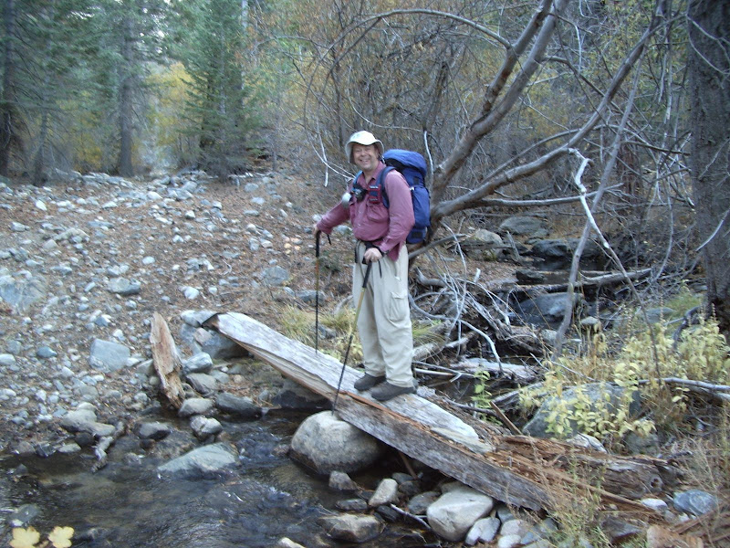
This contents of this TR are is the results of my two scouting trips on October 10, 2008 and November 2, 2008 of the lower Fish Creek area. This TR documents not only that which is necessary to complete the Fish Creek loop but also other tracks and trails in the lower Fish Creek area.

Lower Fish Creek Tracks and Trails
Fish Creek flows through the northeastern portion of the San Gorgonio Wilderness. There are two official trailheads, "Fish Creek" (Point "A") at the upper end of road 1N05 and "Aspen Grove" (Point "B") which is en route to the "Fish Creek" trailhead. See linked map: http://mapper.acme.com/?ll=34.14598,-11 ... ntain%20CA

However, in addition to these trailheads, there are several other ways to access Fish Creek.
Point "C" -- The abandoned road to the old Fish Creek Trailhead
Point "D" -- The access road to abandoned College Camp
Point "E" -- The access road to the cabins in the vicinity of the S Fork CG
Point "F" -- The Lost Creek Trail trailhead.

Further details of the routes from points "C" through "F:"
Image

The Fish Creek Loop
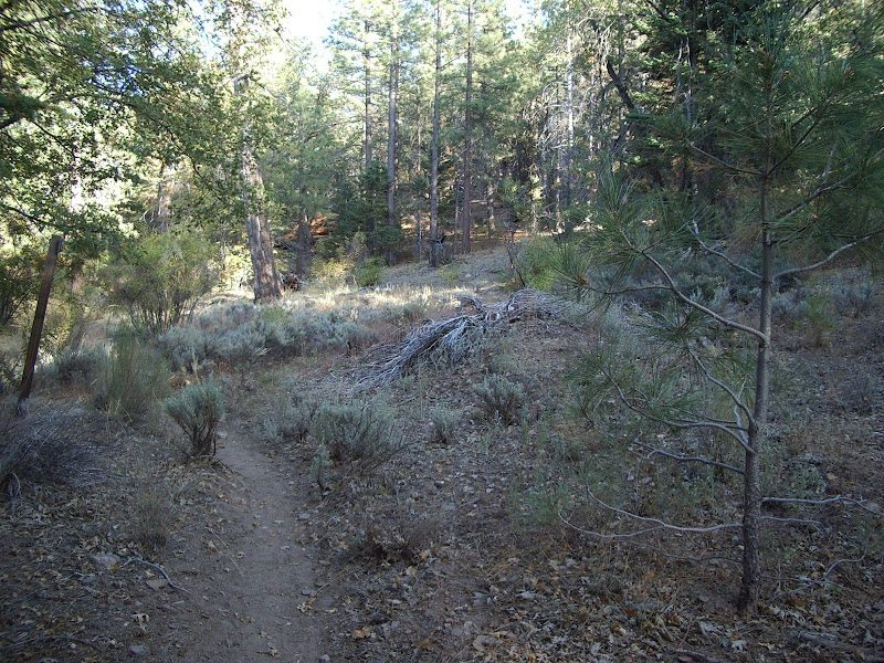
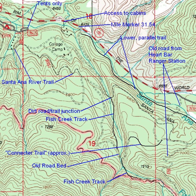
To get to Fish Creek from S. Fork CG, one starts at point "F" on the Acme map. One can either follow the Santa Ana River Trail all the way from point "F" (one follows the signs for the Lost Creek Trail first) or one can cut through S Fork CG, heading towards the Tents Only loop. There is a dirt access road along Lost Creek to some cabins in the S Fork CG area. Head south on this access road, and join the Santa Ana River Trail just past the last cabin. Whether taking the Santa Ana River Trail the whole way or taking the short cut through the CG, head east on the Santa Ana River Trail to the point marked "dirt road/trail junction" on the inline topo map image above. [Actually the junction should be a little left of where I've marked it. Take a close look at the topo image; you'll figure it out.] Turn right here, staying on the Santa Ana River Trail. The Santa Ana River Trail will turn left in perhaps a quarter mile, but continue on a well worn track that goes through a distinctive cut in a large log up the creek to stay on the route for the Fish Creek Loop. The slides linked to in this post have a photo of the cut in the large log. Continue upstream on the track which joins up with an old road bed. After a bit, the old road bed, crosses the creek and climbs out of the canyon. However, to stay on the route for the Fish Creek loop, turn right off the old road bed just past the stream crossing, stay on the Fish Creek Track, and continue up Fish Creek. The point at which the Fish Creek Track leaves old road bed is marked by a small wooden sign that says "trail." The Fish Creek Track continues up Fish Creek, eventually joining up with the route coming in via the old road from the Heart Bar Ranger Station and then finally joining the regular trail NE of Aspen Grove.

Alternative Trailhead
As an alternative to points "E" and "F," point "D" could be used as the trailhead for the Fish Creek loop. To find point "D," proceed up highway 38 about 0.7 miles past the entrance to S Fork CG. Just past mile marker 31.54 (and I do mean just past, as in about two feet), there is a dirt road leading down toward the Santa Ana River. The dirt road as of 11/2/2008 is passable for passenger cars. The dirt road leads down to a spot large enough to park two or three cars on the north bank of the Santa Ana River. The dirt road shown on the inline topo map above leads south from this point but is blocked by a locked gate. Follow the dirt road south to the previously referenced "dirt road/trail junction" and continue the route as described above. This alternative trailhead is a bit more scenic than the main trailhead. Also, if one were just interested in taking a day hike to Aspen Grove, this would make a very nice trailhead.

Other notes
There are a number of other trails in the area which one could use for day hikes or other alternative routes. I won't go into them all, but hopefully the inline topo map will show them well enough.
User avatar
HikeUp
Posts: 3861
Joined: Thu Sep 27, 2007 9:21 pm

Post by HikeUp »

Nice TR(s) - good info. Missing one thing though...did you have fun? :D
User avatar
Hikin_Jim
Posts: 4686
Joined: Thu Sep 27, 2007 9:04 pm

Post by Hikin_Jim »

:lol: :lol: Good point, and yes I did. Just look at that smilin' face.
Image
User avatar
simonov
Posts: 1087
Joined: Tue Nov 27, 2007 5:44 pm
Location: Reno, NV
Contact:

Post by simonov »

Jim,

I'm planning a walk through the Aspen Grove this fall when the leaves change and was considering an alternative to a start at the Aspen Grove Trailhead. Last year we walked from the trailhead to Fish Creek Meadow and it seemed that most of the prettiest aspens were clustered around the lower part of the trail. As we hiked up towards the meadow we saw less and less gold.

So what I was thinking of doing this year was spending more time at lower elevations. I like the idea of starting at C on your map and hiking up to the meadow. But I have a couple questions:

1. Is there anywhere to park at C?

2. Is the trail along the old roadbed easy to follow up to the Aspen Grove Trailhead?

This was last year, near the Aspen Grove Trailhead:
Nunc est bibendum
User avatar
Hikin_Jim
Posts: 4686
Joined: Thu Sep 27, 2007 9:04 pm

Post by Hikin_Jim »

Nice quote you've got there. I scored a Colin Fletcher book at the library today, The Thousand Mile Summer. I've heard so much about him that I'm really looking forward to it.

Yes, there is some parking there. I'm not sure how many cars it will accomodate. I guess you could check it out next time you do a Noob Hike at Johns Meadow.

Take a look at this satellite photo. You'll probably want to zoom this in a bit. "A" is where you turn off 38. "B" is where I parked last time. There may be a couple of more spots at "C."

The old roadbed is very easy to follow once you leave the Santa Ana River Trail. The real trick is to find a) the trailhead near Hwy 38 and b) the point where you leave the Santa Ana River Trail. I'm going to go into great detail below, but hopefully I don't make this sound harder than it really is. Alternatively, you could just go straight up Fish Creek from Hwy 38. The nav is a snap going up the creek. There isn't really very good parking however if you go straight up Fish Creek.

SPOILER WARNING
I'm about to describe the details of the trail. If you want to practice your land navigation, skip the rest of this post. :)

How to find the trailhead: There is a locked gate at "D." Just past the locked gate, there is a circular pull out, "E." From "E," go due SW under the fence and look for an old road "dragger" near "F." Yes there's a road marked on the topo, but it's pretty gone right there. This is what the dragger looks like from the fence:
Image
From the dragger, go south then SE to point "H." Avoid the more prominent track that heads to "G." The track looks like this:
Image
Go down it and then turn to the right sort of toward the pine trees that are just in frame on the right. You then need to cross the Santa Ana River at about "I." It's a bit overgrown at this point on the north bank. Image

The south bank isn't too bad. Below is a photo. Head up the trail you see which will bend to the left when you get into the willows you can see in the photo.
Image

You'll soon pass what I mark as the "lower, parallel trail" on my jpg map on my orginal post in this thread (approximately point "J" on the Acme satellite photo). Cross the "lower, parallel trail" and proceed SW to WSE up an old cut into the hillside. You'll hit a sort of "bench" at the top of the cut and run into the Santa Ana River Trail ("K"). I believe that there is a sign here that simply lists the trail number, "2E03." Turn left (east) on the trail (you could continue to follow the road but the road is more difficult to follow) and proceed to point "L" where the route you want switch backs to the right. You're actually back on the road again at this point; the road has swung around and rejoined the trail at approximately point "M." At point "L," the trail veers left and leaves the old road bed. There is a 2E03 sign here. There is a mound of dirt on the road bed as though someone once blocked it off. It doesn't look like the road continues, but it does. Here's a photo of the critical juncture:
Image
Note the sign post on the left hand side of the photo. Instead of veering left with the trail, go straight toward the "wall" of pine trees you see in the center background of the photo. Turn right just below the wall and follow the road. The road should be obvious from here on out.

When you get to Fish Creek, cross the creek. The trail is on the south side of the creek.

The majority of the Aspens are closer to the "official" trailhead than to where the old road drops in, but this is a nice way in and will take you through the lower grove. Hiking from here to where the "official" trail drops in will take your through the vast majority of the aspens.

Enjoy! :)
User avatar
simonov
Posts: 1087
Joined: Tue Nov 27, 2007 5:44 pm
Location: Reno, NV
Contact:

Post by simonov »

Thanks, Jim.

I think I'll take some time this summer to reconnoiter the trail before taking a group up with me in the fall.
Nunc est bibendum
User avatar
Hikin_Jim
Posts: 4686
Joined: Thu Sep 27, 2007 9:04 pm

Post by Hikin_Jim »

It's kind of a nice route. It takes a hike that hardly seems worth the drive (since it's so short), and turns it into a (IMO) more interesting hike. The last time I was up there (May 1), I went up Fish Creek and came back down the old Fish Creek - Heart Bar road, using the Santa Ana River trail to connect the two, making a loop. I went as far as the drop in point of the "official" Aspen Grove trailhead. I figure it was maybe 8 miles RT and fairly moderate, a hike that most people in modest shape could do. It's a nice area.

If you want to go up Fish Creek all the way, there are a couple of parking spots a short distance down the dirt road leading to "College Camp" (as it's marked on the topos). The road is fairly rough. I can do it in my Accord, but I'm not sure most people would feel comfortable taking a passenger car down that road. There are some nearby turn outs on 38. I think parking directly on 38 is a bit of a downside. At the Heart Bar entry point (the old road we've been discussing), you're at least off of 38.
User avatar
outwhere
Posts: 323
Joined: Sun Jan 25, 2009 5:40 pm

Post by outwhere »

Very cool, thanks for this... haunting pictures of that old road too - I do admit to getting a little sentimental when I see these old roads getting covered - probably a lotta stories/memories on that old road :?
User avatar
outwhere
Posts: 323
Joined: Sun Jan 25, 2009 5:40 pm

Post by outwhere »

Forgot to ask... isn't there a place down there called Fish Camp? I remember driving down there one time on the way back from Big Bear --- and it was a cozy little set up.

I tried looking up Fish Camp up on the net but didn't find anything, which may not be a surprise because when we stopped by, they didn't seem too interested in making the place a tourist trap. Can't blame them there, seemed liked a slice of paradise, at least when we were there.
User avatar
Hikin_Jim
Posts: 4686
Joined: Thu Sep 27, 2007 9:04 pm

Post by Hikin_Jim »

Was Fish Camp a trail resort? A campground? A trail camp? Was it right off the road or did you hike in?
User avatar
outwhere
Posts: 323
Joined: Sun Jan 25, 2009 5:40 pm

Post by outwhere »

Hi Jim,

Pretty sure it was a trail camp from long time back... I picked up some literature when we were there, we see if I can find it and scan it.

We drove down some dirt road and found the spot but I think we came up a different dirt road. Think this was further down canyon from your trip report.

It was a very pleasant setting. Campgrounds right along the river. A little court area with a nice lawn outside the little store... Makes me wanna go back.

I'll see if I can find out more info...
User avatar
Hikin_Jim
Posts: 4686
Joined: Thu Sep 27, 2007 9:04 pm

Post by Hikin_Jim »

Maybe along the dirt road that follows the Santa Ana River from around S Fork CG over to where the road to Camp Radford comes in (Can't remember the name of the road). I don't think it's there anymore, but it sounds nice.
User avatar
outwhere
Posts: 323
Joined: Sun Jan 25, 2009 5:40 pm

Post by outwhere »

It would help if I could find the dang literature we got on that visit [1999?] - just looked where it should be and it aint :roll: Probably inna box somewhere :x

I'm hoping I'm mixing up the name with another camp and it isn't really closed, it was too nice a place to not be there - but things happen...

Hope I find that brochure... it's driving me crazy already :P
Post Reply