http://www.flickr.com/photos/30922174@N ... 226235121/
Eastfork SG to Wrightwood 4/22 - 4/24
-
Bill

- Posts: 332
- Joined: Thu Jul 24, 2008 6:09 pm
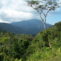
Started on Wednesday 4/22 at Heaton flat parking area at about 9:30 on a beautiful morning. The five of us set out on a 3 day journey up the Eastfork. We passed several groups of gold panners and arrived at the bridge-to-nowhere in the early afternoon. We hiked awhile longer and arrived at lower Fishfork around late afternoon. Nice spot! 8) Last year we did a similar hike taking only two days, and ending at Vincent Gap, but felt like we kinda rushed it in two days. We added a little extra distance and justified one more day adding the Praire fork leg and camping at Cabin Flat. The sign at the junction of Vincent Gulch and Cabin flat trailhead warned that the trail to Cabin flat was impassable.  They were only slightly exagerating as we pretty much bushwacked and log jumped for the next couple hours and finally arrived to a very overgrown and definately unmaintained Cabin flat CG with enougn time to relax a bit and take in the surroundings. Awsome veiws of Baden Powell and Pine ridge from this area and enjoyed the remoteness of the area. The next day took us through Lupine which was pretty well maintained and more views of Pine Mountain, and North devils backbone with the last leg of the journey just a hike up 3N39 where it joins 3N06, PCT and Guffy CG. A little used trail sets out north following a ridgeline down to a fire road and into Wrightwood. A great time was had by all. Aside from a couple of snakes and alot of flies, not much in the way of wild life seen this trip.
http://www.flickr.com/photos/30922174@N ... 226235121/
http://www.flickr.com/photos/30922174@N ... 226235121/
-
Taco

- Snownado survivor
- Posts: 6136
- Joined: Thu Sep 27, 2007 4:35 pm
Hey, cool pics! Overgrown for sure.
-
kgw
- Posts: 133
- Joined: Fri Jul 18, 2008 11:48 am
Ahh, essence of San Gabriel Mtns,
now you guys
reek of it. . .
8)
now you guys
reek of it. . .
8)
-
outwhere

- Posts: 323
- Joined: Sun Jan 25, 2009 5:40 pm
Cool TR...Bill wrote:Aside from a couple of snakes
I don't know why I have an obsession with this, but care to share any slithering details?
Also, how does that Bridge To Nowhere 'area' become private property? Does someone from the private sector actually own it? And if so, who and why? Or is it some ploy to keep the bungie jumpers off it and away?
-
Bill

- Posts: 332
- Joined: Thu Jul 24, 2008 6:09 pm
Well, one of the snakes was kinda cool looking. It was pink or peach in color. One of the guys with me said he thought it was a rosey boa or some such thing. The thing crawled away before we had a chance to photograph it. The other was black with stripe runnig the length of its body. Gardner snake? I really am surprised we did'nt run into more or step on some as often during day two we could'nt see where we were stepping half the time.outwhere wrote:Cool TR...Bill wrote:Aside from a couple of snakes
I don't know why I have an obsession with this, but care to share any slithering details?
Also, how does that Bridge To Nowhere 'area' become private property? Does someone from the private sector actually own it? And if so, who and why? Or is it some ploy to keep the bungie jumpers off it and away?
-
Taco

- Snownado survivor
- Posts: 6136
- Joined: Thu Sep 27, 2007 4:35 pm
http://bungeeamerica.com/nowhr.htmoutwhere wrote:Also, how does that Bridge To Nowhere 'area' become private property? Does someone from the private sector actually own it? And if so, who and why? Or is it some ploy to keep the bungie jumpers off it and away?
Owned BY the jumping company.
-
outwhere

- Posts: 323
- Joined: Sun Jan 25, 2009 5:40 pm
Thanks Taco... now that makes sense.  8) That company bought the bridge? Wonder if was less or more than London one...?
Thanks to you too Bill for the slippery update... Rosey Boa, trying to remember if those are the same as a Red Racer. Prob not.
Those Red Racers are quick though [duh]. Saw one go under the house next to my friend's cabin in the desert. Blew me away how fast that little sucker was... I was on pins and needles the rest of that weekend


Actually we were in the car when we saw it, almost ran over the dang thing, we got so close to it that I actually lifted my feet off the floor board. Snakes will punch right through floor boards ya know...

Man, you guys went through some tough miles on that hike@
Thanks to you too Bill for the slippery update... Rosey Boa, trying to remember if those are the same as a Red Racer. Prob not.
Those Red Racers are quick though [duh]. Saw one go under the house next to my friend's cabin in the desert. Blew me away how fast that little sucker was... I was on pins and needles the rest of that weekend
Actually we were in the car when we saw it, almost ran over the dang thing, we got so close to it that I actually lifted my feet off the floor board. Snakes will punch right through floor boards ya know...
Man, you guys went through some tough miles on that hike@
-
mattmaxon

- Posts: 1137
- Joined: Mon Mar 24, 2008 12:48 pm
A land Patent claim was Issued to the San Gabriel Mining Co on 5/16/1904outwhere wrote: Also, how does that Bridge To Nowhere 'area' become private property? Does someone from the private sector actually own it? And if so, who and why? Or is it some ploy to keep the bungie jumpers off it and away?
S½S½NENE 7/ 2-N 8-W No San Bernardino CA Los Angeles
E½SENE 7/ 2-N 8-W No San Bernardino CA Los Angeles
W½SWNW 8/ 2-N 8-W No San Bernardino CA Los Angeles
SESWNW 8/ 2-N 8-W No San Bernardino CA Los Angeles
W½NESW 8/ 2-N 8-W No San Bernardino CA Los Angeles
E½W½SW 8/ 2-N 8-W No San Bernardino CA Los Angeles
and to E S Saunders & E A Gray on 6/20/1913
W½SWSW 5/ 2-N 8-W No San Bernardino CA Los Angeles
SESESE 6/ 2-N 8-W No San Bernardino CA Los Angeles
N½NENE 7/ 2-N 8-W No San Bernardino CA Los Angeles
NWNWNW 8/ 2-N 8-W No San Bernardino CA Los Angeles
It is no ploy, the Bungee Jumping Co owns the land.... Much to the displeasure of the authorities

-
lilbitmo

- Posts: 1092
- Joined: Tue Mar 04, 2008 9:44 pm
Great Trip Report Bill.
Thanks for sharing the pictures. The views on the backside of the front range looked "Cool (as in colder) and much more pleasant to be in".
How's the snow back there in Wrightwood - like the Acorn Trial and the PCT up to Wright Mountain? Should be starting to "Thin Out"?
Hope to see you on the trial soon.
Lilbitmo
-
AW~

- Posts: 2093
- Joined: Mon Oct 01, 2007 12:00 pm
wow..nice pics..Falls Gulch(#1661 and others) was really flowing...
-
Hikin_Jim

- Posts: 4688
- Joined: Thu Sep 27, 2007 9:04 pm
Hey, Bill,
Good stuff bro. Past the bridge, I assume it was just "find your best route" travelling, yes?
How "bad" were the crossings? I assume you had to wade a lot or were you able to find a lot of dry crossings.
HJ
Good stuff bro. Past the bridge, I assume it was just "find your best route" travelling, yes?
How "bad" were the crossings? I assume you had to wade a lot or were you able to find a lot of dry crossings.
HJ
-
cougarmagic

- Posts: 1411
- Joined: Wed May 07, 2008 5:21 pm
Great trip and pics! Sounds like a cool trip - I've pondered what's in there many times while looking at maps. I'm sure you are one of very few people who have seen what it's like!
Is one of the tents a homemade tarp-tent? One of the pics showed what looked like an ultralight something or other.
Is one of the tents a homemade tarp-tent? One of the pics showed what looked like an ultralight something or other.
-
EnFuego

- Posts: 677
- Joined: Mon Dec 15, 2008 11:14 am
Hey Bill. Nice TR, thanks. Nice pictures too. I haven't been that far back in a mighty long time.
-
Bill

- Posts: 332
- Joined: Thu Jul 24, 2008 6:09 pm
Hi all,
Sorry for the late reply, It's fishing time in the upper Sierra.
Jim- Most of the crossings were not too bad. There were more than a couple that were a little challenging because of fallen logs and such. There really is no trail much beyond Fishfork camp. Good to hear from you my friend, you have'nt posted for awhile.
Cougar magic- No canvasse tents mostly just REI stuff. Was hoping to run into some critters, but not this trip. Probably all the noise we were making as we stomped and thrashed our way through.
Enfuego- Kinda neat to travel through an area so close to civilization and yet so rarely traveled.
AW- That is a cool place those falls.
Lilbitmo- There was only a little bit of snow on the north slopes near Guffy. From Lupine we walked up 3N39 so I did'nt go toward Acorn, but I would assume it was similar. I'll have to show you that route (Guffy trail)if you ever do the death march. The week before, my son and I did the PCT section between Cajon pass, and Clydes ranch and I would imagine the section betwee Clydes ranch and Acorn are relatively snow free, although looking up from below I could still see good snow coverage along the north devils back bone.
