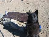
I did a familiar loop…my fourth time doing it. I was planning on taking a buddy on this hike for his first time, but he bailed on me at 4:00 AM. So, I went back to bed and got up at a leisurely 5:30. (He’d had some time constraints, but I did not.) I started at 7:17 AM in Bailey Canyon Park, heading up the Bailey Cyn Trail. I climbed about 2,200 feet in about 3.4 miles in just about an hour. I’ve done that first leg faster before, but I wasn’t feeling too well as I began my day. After a nice break, I veered from the main trail and took the ridge route to Hastings Peak, and eventually to the Toll Road. By then, I was feeling more like my usual self. I kept on moving, and didn’t stop until I was on the Wilson summit. I had climbed about 4,700 feet in about 8 miles. The up and down, following the ridge, is the toughest part of that workout. Well, at least I think so.
I made the summit at 10:05, which wasn’t bad considering my break earlier was about 25 minutes long! Honestly, I’d sat there, contemplating giving up for the day. Well, as I enjoyed the lovely sunshine and light breeze on Wilson, I was glad I’d pushed through it. I was feeling great, and had a pleasant conversation with a very nice hiker. He was ramping up his training for Mt. Whitney. His boss was too, but was somewhere down the trail.
You know, almost every Saturday I have someone ask me if I’m training for something. I usually say nothing in particular. But, I am backpacking in Grand Canyon next month, and I will hike Whitney, likely twice, this summer. Then there will be other trips I have yet to schedule. But I guess I don’t consider my Saturday hikes training right now. I do them because they feel good, and I like to be strong. Anyway, I digress…
I left the Wilson summit around 10:35 and motored my way down the toll road to the Upper Winter Creek rail to Manzanita Ridge, and then finally down the Wilson Trail. I took a couple little breaks on the way. Wow! Wild flowers everywhere! It was a lovely sight, and the weather was fantastic. It did warm up, I’d say to about 82-84 degrees, but I was heading downhill, not at all envying the folks who were just beginning their climb. (Why do I always see people hiking uphill in the heat, wearing long sleeves and dark clothing, carrying no water, looking just utterly miserable?)
Once down to the trailhead, I had to walk .7 mile to my car. I was done by 12:57, so I did the whole loop, including breaks, in 5 hours 40 minutes. Not terribly shabby. I’ve posted so many Wilson TRs and pics, I tried not to take the same old, same old photos. I did take some today, but I tried to include some pics of wild flowers. They were my favorite part of the hike. Pics are here: www.flickr.com/photos/33777171@N06/sets ... 953150139/
Springtime on Wilson 3/28/09
-
lik2hik

- Posts: 82
- Joined: Sun Sep 30, 2007 8:46 am
Liz:
Thanks for the report. Nice pictures of the wildflowers. I tried taking some photo's of the flowers last Sunday - in the rain. didn't turn out so good. It's been almost a year since the fire on the lower part of the Mt. Wilson Trail. Amazing how much new growth has occurred since then.
Thanks for the report. Nice pictures of the wildflowers. I tried taking some photo's of the flowers last Sunday - in the rain. didn't turn out so good. It's been almost a year since the fire on the lower part of the Mt. Wilson Trail. Amazing how much new growth has occurred since then.
-
lilbitmo

- Posts: 1092
- Joined: Tue Mar 04, 2008 9:44 pm
Nothing wrong with "Same Old, Same Old" if we get out the Urban life just for moments, it's all worth it. Sorry I did not get the message until late last nigth, I might have tried to tag along.
I ended up driving up Sky Line Road in Corona to the "Main Divide Road" with my three dogs, did a little "Recon" on a Ortega to 91 Freeway hike that Bryan and I have planned for later in the month of April. I stashed some water so we can go super light and fly.
The wild flowers look assume.
Thanks for the Trip Report.
lilbitmo
-
Liz
- Posts: 218
- Joined: Mon Dec 22, 2008 8:59 am
Hey Libitmo! I'd actually like to drive the Main Divide Road to the Maple Springs area. From there I'd like to take the switchbacks of the West Horsethief Cyn Trail...alll the way to the Canyon. Then I wanna turn around and go right back up. My hubby and I will be in Grand Canyon soon, and it's always helpful to do some down/up hikes to prep.
What kind of vehicle do you need to drive the Main Divide Road? I've seen short segments of it, and it looks okay for all cars. But I don't want any surprises for my lil Corolla.
What kind of vehicle do you need to drive the Main Divide Road? I've seen short segments of it, and it looks okay for all cars. But I don't want any surprises for my lil Corolla.
