Snack Shack Couloir and Thunder Ridge, 15-Mar-2009

TRs for the San Gabriel Mountains.
Post Reply
User avatar
Tim
Posts: 560
Joined: Tue Apr 08, 2008 8:55 pm

Post by Tim »

I don't know if this couloir has a name, but it's the one that empties into the Snack Shack at Manker Flats.

I didn't plan on doing this climb but it worked out pretty well. I originally wanted to climb Baldy, but halfway up Falls Rd I turned around because my new backpack was bothering me. This pack was a North Face Pivot 22. It's a nice little technical daypack but the shoulder straps kept digging into my neck.

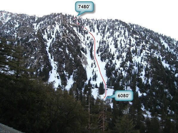
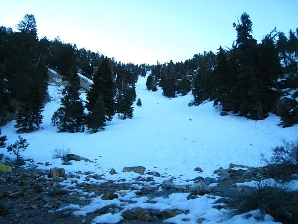
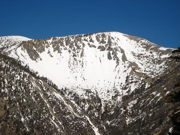
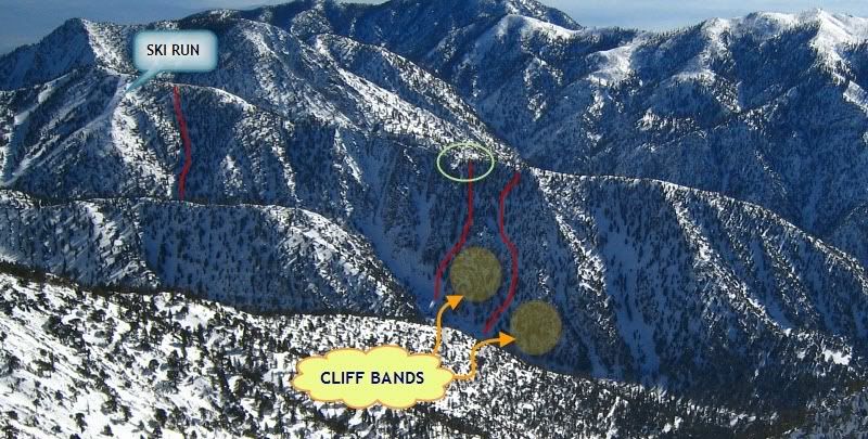
As I was walking back to my car to get my other pack, I spotted this couloir. It looked doable and best of all the approach consisted of walking across the road. Perfect! I was too lazy to hike back up Baldy anyway. The topo indicated it was a 1400 ft climb, although it didn't look very high. Once on top I figured I would follow the ridge to Thunder Mtn and then descend one of the ski runs.

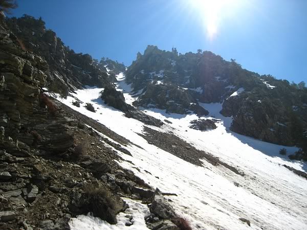
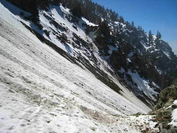
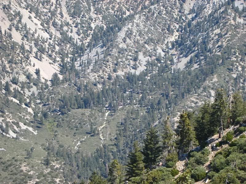
The couloir starts at 30° and steepens to almost 40° near the top (as measured in Photoshop). The snow was very hard packed and somewhat icy, but pretty good for cramponing. You couldn't really self-belay, though, because the axe wouldn't go in more than an an inch or two. Also, maybe my technique was off, but my ankles were killing me from constantly having to twist them to the angle of the slope.

At 7,250 ft, the snow changed to a soft top layer with a hard icy layer underneath. I didn't feel safe climbing here anymore so I exited the couloir and climbed the bare dirt and rocks on the left side. I topped out at 9:30am--about 1:45 hrs after I started.

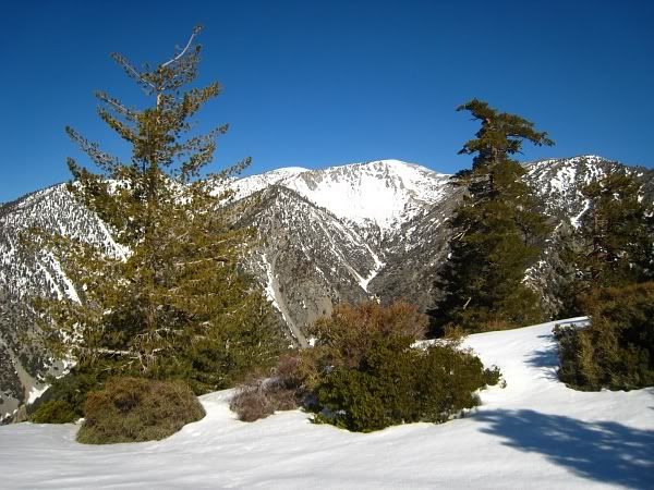
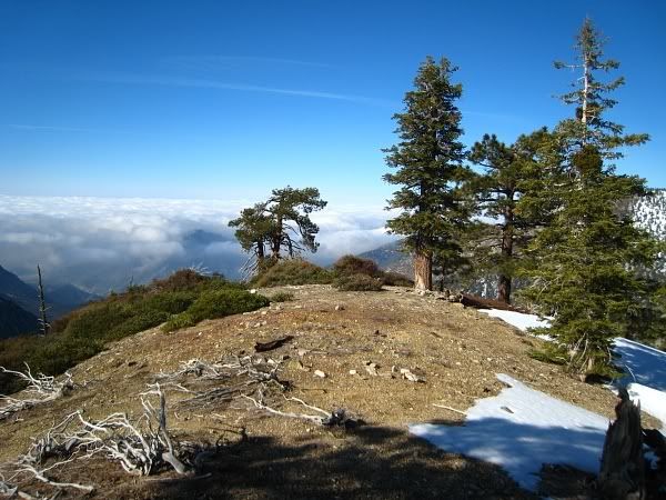
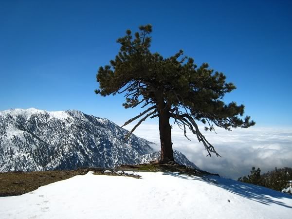
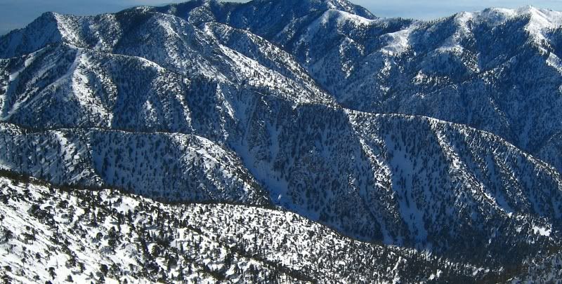
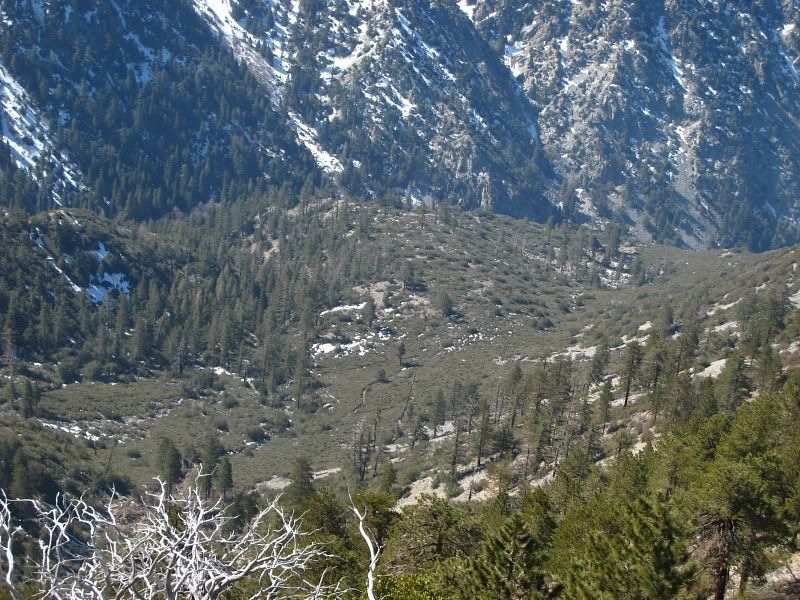
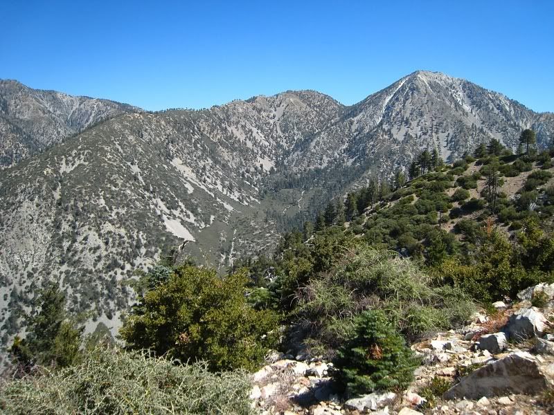
The views at the top were really sweet. The ridge drops off sharply so there was nothing in front of me except air and two huge mountain ranges (Ontario to the south and Baldy to the north). I even started to get a bit of vertigo while looking at the Ontario Peak Ridge, which rises more than 3,000 ft from Icehouse Canyon.

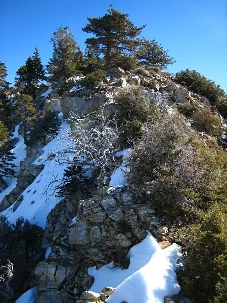
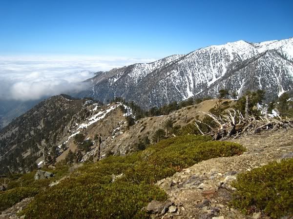
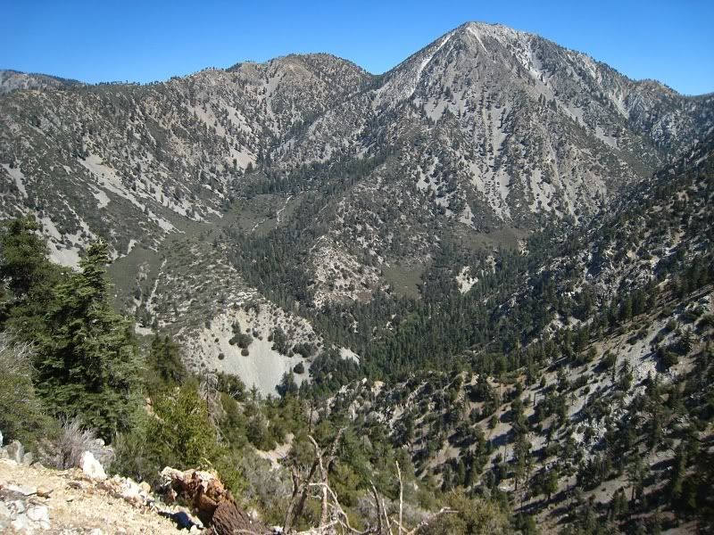
After regaining my senses, I continued east along the ridge. Overall, it was a straightforward traverse, but there were a couple of short sections where I had to scramble over some rocks and bushes. At noon I arrived on Thunder Mtn. I loitered around a bit and then made my way down to Miner's Bowl.

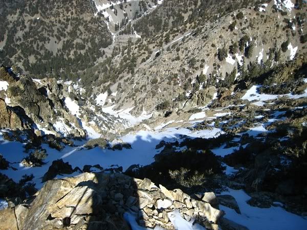
From there, I took Big Butch Wash down to where it meets Lightning Couloir. When I got there, a cloud moved in really fast and reduced visibility to almost nil. This was no good at all. Rocks were constantly raining down this gully every few minutes. I thought about making a run for it down the couloir, but the sound of more falling rocks convinced me to hike back up to Miner's Bowl and take the gully beneath Chair 1. I got back to my car at about 3pm.

Image
Image
Image
Image
Image
Image
Image
Image
Image
Image
Image

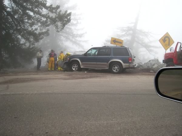
Literally within seconds, this:
Image

turned into this:
Image

This was at the first hard left switchback as you're going down the road. He went straight into the turnout and head-on with the boulder. Visibility was down to 20-30 ft. Must not be familiar with the road or must have missed the 10 mph caution sign.
Image
User avatar
EManBevHills
Posts: 387
Joined: Fri Sep 28, 2007 12:40 am

Post by EManBevHills »

Looks like your timing was better than our favorite debris magnet....
Great perspective from the top of the gully.
User avatar
lilbitmo
Posts: 1092
Joined: Tue Mar 04, 2008 9:44 pm

Post by lilbitmo »

Tim,

Great report, nice work. Rocks were raining down the Baldy Bowl all day Saturday as well.

Pictures are great as well.

Way to get away from the rock fall, it's no fun dodging them :D
User avatar
Sashimi
Posts: 30
Joined: Fri Oct 26, 2007 7:10 pm

Post by Sashimi »

awesome trip report.
I saw that couloir last week but haven't had time.
great shots with the camera as well.
User avatar
406
Posts: 321
Joined: Thu Jan 17, 2008 10:36 am

Post by 406 »

Nice work. Looks like the snow is still pretty clean in the couloir. Surprised it wasn't softer, but maybe because you hit it so early in the day.
User avatar
EnFuego
Posts: 677
Joined: Mon Dec 15, 2008 11:14 am

Post by EnFuego »

Tim - You son of a gun. I saw that couloir all day Saturday when I was going up Baldy bowl. I kept telling the person I was with "god, I wish I could climb that today. I need to get over there before end of week". I think I'll skip a day of work and head out there Thursday or Friday.

Thanks for posting this. I could use the Beta. Hey, is there any other descent route other than heading over towards the ski area?

Nice job and nice pics.
User avatar
LD
Posts: 93
Joined: Sat Jan 31, 2009 10:03 pm

Post by LD »

Nice Tim!
I see that couloir every time I come down Baldy putting it on the future list. Thanks for the TR and picts.
When you topped out how did you get the chance to look at the ridge toward the SW? I was thinking of doing a 3T’s beginning in Ice House and ending at Thunder and following the ridge line down to Ice House. Was there a lot of brush? Trees and rocks we don’t mind. :)
User avatar
Tim
Posts: 560
Joined: Tue Apr 08, 2008 8:55 pm

Post by Tim »

Thanks all!

406: The snow is very clean there. No real evidence of rockfall and only a few sporadic tracks at the top. So someone has been here already.

EnFuego: There are a few possible descent routes if don't want to go all the way to the ski area. Here's an older picture of the ridge and some possible routes I sketched in. I can't vouch for any of them, though, because I've never been down 'em. Exercise caution because some areas appear to have cliff bands or don't have snow in them.

Image
Image

LD: Coming down the ridge seems doable, although it might be a wild scree descent. The problem is once you get to the gully it seems to get really brushy. But there seems to be some sort of path or creek going through it. Here are some recon pics from Thunder Ridge and from Sugarloaf:

http://i305.photobucket.com/albums/nn20 ... 09/tr1.jpg
http://i305.photobucket.com/albums/nn20 ... 09/tr2.jpg
http://i305.photobucket.com/albums/nn20 ... 09/sg1.jpg
http://i305.photobucket.com/albums/nn20 ... 09/sg2.jpg
http://i305.photobucket.com/albums/nn20 ... 09/sg3.jpg
User avatar
norma r
Posts: 707
Joined: Thu Nov 06, 2008 4:22 pm

Post by norma r »

Good job Tim!

I was on Baldy Bowl very early saturday and never heard a rock fall and then went up Falling Rock Canyon early sunday morning and again not one rock fell. As you know FRC is pretty sheltered and doesn't get much sun. Plus the early morning affords some comfort when all is cold and still hard. Had i heard rocks on FRC i probably would have turned around. I still have visions of Taco's hand in my head.

The snow in FRC and the slopes of Ontario were great for pons and axe. i should have a TR up tonight.

we saw a helicopter hover and seemed to land between Icehouse and Timber. anyone know what that was about?
User avatar
Taco
Snownado survivor
Posts: 6010
Joined: Thu Sep 27, 2007 4:35 pm

Post by Taco »

Cool stuff dude!
User avatar
yoskolo
Posts: 56
Joined: Wed Dec 31, 2008 10:34 am

Post by yoskolo »

Snack Shack Coulier does have a nice ring to it.
User avatar
LD
Posts: 93
Joined: Sat Jan 31, 2009 10:03 pm

Post by LD »

Tim wrote:wild scree descent.
My favorite kind :D
Thanks Tim
User avatar
Taco
Snownado survivor
Posts: 6010
Joined: Thu Sep 27, 2007 4:35 pm

Post by Taco »

BTW, I'm also rather happy you never chose to climb Lightning Couloir. It's proving to be a bad idea this season. 4 attempts for me, one ascent, just too much rockfall.
User avatar
Tim
Posts: 560
Joined: Tue Apr 08, 2008 8:55 pm

Post by Tim »

Yeah, your incident in that couloir was definitely on my mind. No way I was going in there! The other thing is I climb solo so I can't really afford to have too much go wrong. Thus I tend to be pretty conservative in my decisions during the winter.
User avatar
Taco
Snownado survivor
Posts: 6010
Joined: Thu Sep 27, 2007 4:35 pm

Post by Taco »

Better to be conservative, the route will be there later. Unless it's out of condition... :lol: then you have to climb it NOW, and you get hurt by rockfall, since it's never "in condition". :lol: :lol:
Post Reply