http://www.flickr.com/photos/30922174@N ... 507880636/
Swarthout ridge to Wrightwood
-
Bill

- Posts: 332
- Joined: Thu Jul 24, 2008 6:09 pm
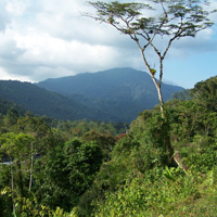
I decided to do the hike from Swarthout to Wrightwood I recommend to Liz on this forum. The entire trail has a 3200 foot elevation gain over about 6 miles, and a shuttle is required in Wrightwood. Basically this hike follows the ridgeline that parallels Lonepine Canyon and is the San Andreas upthrust on the north side. This hike is approx. 1 mile west of interstate 15 off of the 138 and Lonepine Canyon Road. The TH is on the N side of Lonepine at Swarthout Canyon road and the trail is a little obscured by brush. Use care crossing Lonepine as cars rip through this area and it is a blind curve.  Shin protection is a must as the first third of the trail is choked with yuccas. We ran into a couple of patches of snow in some shaded areas that was soft and mostly shallow, but we did run into a couple of deeper spots (knee deep) Crampons would be necessary if you take the route to Horse Canyon to the north. We chose a steep west facing slope with a few patches of soft snow on it that was mostly avoidable. I immagine if the weather was'nt as nice as it was (temps in the 60's) ice could be a problem. We did not need crampons or snowshoes however.
http://www.flickr.com/photos/30922174@N ... 507880636/
http://www.flickr.com/photos/30922174@N ... 507880636/
-
lilbitmo

- Posts: 1092
- Joined: Tue Mar 04, 2008 9:44 pm
Bill,
Is this a portion of the trail that is a part of the PCT or is this on the ridge line North West of the PCT?
Trying to picture it in my mind from doing the PCT in that area?
Thanks
Lilbitmo
Is this a portion of the trail that is a part of the PCT or is this on the ridge line North West of the PCT?
Trying to picture it in my mind from doing the PCT in that area?
Thanks
Lilbitmo
-
Bill

- Posts: 332
- Joined: Thu Jul 24, 2008 6:09 pm
PCT in that section follows what I am calling Swarthout ridge from interstate 15 and then crosses Swarthout Canyon and follows blue ridge the length of LonePine Canyon and beyond. The ridge I hiked yesterday is North of PCT. So PCT looking north goes as follows: (PCT)Blue ridge, Lonepine Canyon, Swarthout ridge, and Hwy 138. So basically this is the ridge that divides the 138 from Lonepine Canyon.lilbitmo wrote:Bill,
Is this a portion of the trail that is a part of the PCT or is this on the ridge line North West of the PCT?
Trying to picture it in my mind from doing the PCT in that area?
Thanks
Lilbitmo
I hope that makes sense. 8)
-
AW~

- Posts: 2093
- Joined: Mon Oct 01, 2007 12:00 pm
nice to see the other side...where the 'big one' is supposedly going to take place.
