

Thanks.TacoDelRio wrote:HAHAHAHAHAHAHAHAHAHAHAHHAHAHAHA YES!
Bill, I hope ya get through with yer family without anything bad happening.
Actually the kids are loving it as they are getting an early start to their Christmas vaction. 8)
Thanks.TacoDelRio wrote:HAHAHAHAHAHAHAHAHAHAHAHHAHAHAHA YES!
Bill, I hope ya get through with yer family without anything bad happening.
I feel yah, Mike.MikeSash wrote:Here in Palmdale (2000 ft) we got hammered! I can only imagine what our side of the SG's got. Probably 7-8 inches where I live, snowed all day and only stopped about an hour ago. I've never seen snow fall like this in Palmdale. You can go outside and listen for about 5 minutes before you hear a tree limb crack and break under the foreign weight.
This morning there was snow, visible from La Crescenta, about 500' below the summit of Mt. Lukens (which is just over 5000').HikeUp wrote:Web cam on top of Josephine...
http://www.fsvisimages.com/saga2/saga2.html
Currently (Friday morning) shows snow on the east ridge of Josephine which is around 5200' - 5500' - similar to Mt. Lowe. I'd guess west ridge of Brown is mostly clear except in well shaded areas and the north side of Lowe has plenty of snow on the mostly shaded trail. Whether that snow is packed down and icy depends on how many boots have gone over the trail.
Thursday morning the snow was down to about 3600' but it was well over 4500' by Thursday afternoon - as seen from Pasadena.
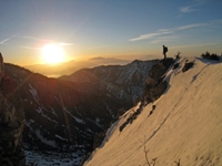
Nice pix.glamisking wrote:Went up baldy Wed. night and woke up to a white wonderland under warm blue skies. The snow was deep and soft; even with snowshoes! Although the seasons was late to start, it was worth the wait! See pictures below.
http://www.facebook.com/album.php?aid=2 ... d=68602558

You've got that right. Wow. Sounds really nice.glamisking wrote:After 2:30 AM the snow stopped and the moon light up the whole valley. There is nothing which can compare to the traquility of snowshoeing on fresh snow, in the moonlight, without a headlamp!
Your pics in the Waterman area look really nice. I haven't been able to get up to the mtns,do to holiday shopping (yuckbrian90620 wrote:Here are some new snow pics...............
On Wednesday My gf and I drove up to the Mount Waterman area (right off the road) while it was snowing, to play in the at least 2 and a half feet of fresh powder in the area. There were definitly drifts that were deeper though. It was fun for the most part, but the sledding was not that great due to the new snow not being packed at all.
Pics: http://picasaweb.google.com/brian90620/ ... #slideshow
Also, on Thursday we went to the Cleveland National Forest for a change since there was an incrediable amount of snow there 8) ........ We hiked up Silverado Motorway off Maple Springs road to approx. within a mile of the Main Divide Road (dirt). Above 3000 feet where we were hiking there was about 6 inches of snow, but Im sure there must have been alot more on Santiago Peak.
Pics:
http://picasaweb.google.com/brian90620/ ... #slideshow


