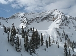
2 Hikers Spend Unplanned Night on Mt. Baldy
A pair of USC students were found after getting lost on Mt. Baldy in Southern California and spending the night on the mountain.
Stephen Lue and Derek Zhao, both 20, were hiking on the mountain on Wednesday. This was the first time on the mountain and both were unfamiliar with the trails. Around 5:15 p.m., one of the hikers called 911 to say they were lost.
Sheriffs and the West Valley Search and Rescue team responded to the location. They were unable to find them as night fell.
Around 5:30 a.m., right around sun-up this morning, the pair were found in Goode Canyon at an elevation of 8,500 feet. They were both in good condition.
2 Hikers Spend Unplanned Night on Mt. Baldy
-
Hikin_Jim

- Posts: 4688
- Joined: Thu Sep 27, 2007 9:04 pm
Somebody needs to hook these two up with Joe. He'll straighten 'em out.
-
Tim

- Posts: 560
- Joined: Tue Apr 08, 2008 8:55 pm
Goode Canyon strikes again! Seems like an exact repeat (even the same elevation) of what happend to these two guys in June. People seem to be missing that turn east as you leave the ridge and go down the forested slope to the bottom of the bowl.
http://www.dailybulletin.com/search/ci_9687234
http://www.dailybulletin.com/search/ci_9687234
Created: 06/24/2008 08:51:12 PM PDT
MT. BALDY - Two men stranded on this mountain overnight were found uninjured, rescued by helicopter, and returned to their families Tuesday morning.
San Bernardino County sheriff's deputies received a call shortly after 10 p.m. Monday, reporting that Louis Kim and Stephen Kang, both 28, went to the Mt. Baldy area to go hiking that morning.
The unidentified caller told authorities the hikers were due back by 5 p.m. and neither of them was answering his phone.
The caller gave a description of the hikers' vehicle, which was parked near Mt. Baldy and Falls roads, said sheriff's spokeswoman Arden Wiltshire.
Because overnight conditions were good, officials were able to send out a helicopter, and the hikers were spotted in Good Canyon around 1:30 a.m. Tuesday.
"They were found about 8,500 feet up," Wiltshire said. "That's pretty far from their vehicle."
Deputies told the men to stay put and they would be rescued. The men signaled back to the helicopter crew with a flashlight that they understood the instructions.
By 9:30 a.m., the men had been hoist-rescued from the canyon. Wiltshire did not know why authorities decided to rescue the men by helicopter rather than leading them out on foot.
Both Kim and Kang, who have hiking experience, had packed food and water for their trek.
Summer rescues like this are not uncommon because there are more hikers out during this season, Wiltshire said.
"People start off great with the buddy system, which we highly recommend, but somewhere the partners will get separated and lost," she said. "Or people will wander away and get off the trail. That really creates a problem."
-
Taco

- Snownado survivor
- Posts: 6135
- Joined: Thu Sep 27, 2007 4:35 pm
My buddies accidentally went down Goode canyon as well during a storm... they made it out OK. CMF FTW!
-
JMunaretto
- Posts: 370
- Joined: Thu Feb 07, 2008 11:03 am
-
HikeUp

- Posts: 4036
- Joined: Thu Sep 27, 2007 9:21 pm
It's the canyon with the plane wreck in it that you see from the ski hut/baldy bowl trail. The plane wreck directly below this sign...JMunaretto wrote:Is it A, B, or some other canyon?

My guess is that people are entering into Goode Cyn at the point where the sign pictured above is. The sign is not fixed in the ground and is usually jammed in between some rocks and usually points down the use trail that leads to the plane wreck down in Goode Cyn. I think the sign should be eliminated.Tim wrote:People seem to be missing that turn east as you leave the ridge and go down the forested slope to the bottom of the bowl.
In fact, during the group hike back in October led by Kurt, we were descending and we all saw two hikers down by the plane wreck and they asked us where the right trail was.
-
Tim

- Posts: 560
- Joined: Tue Apr 08, 2008 8:55 pm
Good point. That's definitely a possibility. Usually you only see a sign at trail junctions. I use to think that sign was the split to Bear Canyon. I've been down to the Hellcat wreck but there isn't much of a use trail after that. I guess if you're not familiar with the mountain you would just keep going down hoping to pick up the trail again. It wouldn't be long before you realized something is seriously wrong but by that time you'd be well below the ridge where you turn east to the bowl.HikeUp wrote:My guess is that people are entering into Goode Cyn at the point where the sign pictured above is. The sign is not fixed in the ground and is usually jammed in between some rocks and usually points down the use trail that leads to the plane wreck down in Goode Cyn. I think the sign should be eliminated.
