
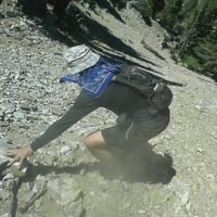
Lower Eaton Canyon is well known for its rugged topography and waterfalls. In contrast the upper and middle sections are very pleasant with relatively mellow scrambles to get through them. The middle section can be visited by taking the Idlehour Trail and the upper section is a trailess jaunt from Eaton Saddle. My goal this time was to hit up the upper canyon and see what it was made of. I already had beta that technical equipment would be unnecessary so wasn't too concerned about getting to my objective the Idlehour trail where it crossed over the canyon.
The Eaton canyon headwall is very impressive indeed as it is represented by the escarpment dropping precipitously off of the side of San Gabriel Peak. Any entry prior to the tunnel would be very steep and probably foolhardy. Once past the Mueller Tunnel the steepness decreases and obvious vegetation hints at an easier entry to the canyon floor. My point of entry was the gully immediately after the red retaining wall sprayed with charming graffiti. The gully was a good choice as it was brush free and not too steep but caution had to be taken as the rocks are very loose.
A gully from the left meets this one and then one from the right and next thing you know you're deposited into the main stream bed that will make up Eaton Canyon. I left a duck at this entry point in case I had to return this way for whatever reason. Once on the main waterway you get to find all the detritus that has washed down from the road above. Old wiring, signs, and rusted metal from the construction of the tunnel and probably the old walkway.
The canyon continues to be pretty loose with the rock but very open as you hop your way slowly down the dry creekbed. Soon you're below the east monolith of Markham looking up steep loose rock at its summit 700 feet above you. This section had little vegetation in the bed itself as it was completely dry. A sizable gully enters from the gap between Lowe and Markham and marked the first spot I saw water in the canyon. This quickly disappears but the sections with water flowing get more frequent and can be expected as you see more vegetation growing along the creek bed.
A couple of highlights of the hike are the narrows which are very short maybe 50 feet where the walls of the canyon tighten up to maybe 30 feet across and walls are on both sides. The right side continues to have significant walls but the left turns to more of an earthen slope. A little further beyond this point you come to your only obstacle a 20 foot waterfall that can't be down climbed safely. An obvious easy bypass to the left up and over and then down a rocky slope gets you past the nicest looking spot in this section of the canyon.
As you get past the waterfall the canyon opens up again and the water disappears. This section the streambed is wide with minimal rocks making for the quickest hiking of the whole day. Finally you reach a big tributary coming in from the left called Deer Park which runs between Occidental and Wilson. The canyon continues to remain wide but this section had the most downed trees and brush which slowed things down. Finally I reached a leafy section with flowing water and continued until Idlehour trail crossed over the stream. The trail was actually just above the stream as I was making my way down for the last 1/4 mile but it was almost impossible to see. If you want to be a bit more efficient then just before the creek drops back down into the foliage clamber out to the right and you should meet the trail as it first reaches the canyon floor in the wider clear section of the canyon maybe .3 mile after your junction with the Deer Park tributary.
I reached the trail after 2.5 hours of sustained hiking/scambling. I realized I probably lost about 15 minutes by not exiting the creek at the optimal point but it was still a fun additional jaunt. I now had the unenviable task of climbing 2,500 feet back to my car. My legs felt good but my feet were pretty trashed from all the clambering, hopping, and crappy rock. Idlehour is a long trail there really is no way around it from both sides. The hike back up to the Mt Lowe road took about a hour and fifteen minutes. The trail near the creek was a bit overgrown but once on the slope it is in good shape with a couple of narrow spots towards the top just before you get into the burn area. I took my first real rest at the point that I finished the trail and also saw my first hikers since I dropped into the canyon.
From there it was my first time on the East Mt. Lowe trail back to the TH. This trail is also in good shape with only one minor washout spot but otherwise an efficient mileage route back. I was able to make it back to my car from my rest spot in only a hour. Overall just under a five hour hike through a really pretty remote section of canyon that doesn't require any technical skills to get through it. I would suggest this hike for the spring as it will get dry and very hot in the summer.
Upper Eaton Canyon Scramble
Thanks for the report. I've been curious about that stretch of canyon for quite awhile. Incidentally, did you happen to notice whether the ridge up to Markham from Eaton Canyon looked climbable?
Markham is surrounded on all sides from the canyon by some serious buttresses. The only option which would require some serious bushwhacking would be to come up the draw immediately after Markham which would take you to the saddle between Lowe. If you were a climber then there would be other options even though the rock looked pretty crappy, I think Taco has tried climbing here.
The ridge that looked the most promising for future hiking is the one that leaves from the Deer Park/Eaton confluence and climbing up to Occidental Peak which could make a neat loop. There is some brush but not too terrible and doesn't appear to have any climbing obstacles.
The ridge that looked the most promising for future hiking is the one that leaves from the Deer Park/Eaton confluence and climbing up to Occidental Peak which could make a neat loop. There is some brush but not too terrible and doesn't appear to have any climbing obstacles.