
Search found 268 matches
- Fri Jan 11, 2008 9:43 pm
- Forum: News & Conditions
- Topic: San Sevaine Road (1N34)
- Replies: 61
- Views: 1406
Re: San Sevaine Road (1N34)
I still want to hike these peaks. There is a trip report on summitpost. http://www.summitpost.org/trip-report/3 ... tains.html Here is the route I am now thinking, it was mentioned in the HPS route page. Trailhead from the north end of Etiwanda Ave. https://eispiraten.com/images-archived/www.summitp...
- Fri Jan 11, 2008 9:06 pm
- Forum: General Discussion
- Topic: Twin Peaks - Hard Routes
- Replies: 52
- Views: 737
Re: Twin Peaks - Hard Routes
I am trying to figure out the route, how does this look.

Click to see full size image

Click to see full size image
- Fri Jan 11, 2008 6:53 pm
- Forum: The Pub
- Topic: Day hike recommendations in the Santa Monica Mountains
- Replies: 3
- Views: 98
Re: Day hike recommendations in the Santa Monica Mountains
Or for more of an adventure but less distance try Brents Mountainsimonov wrote:Anyone have any suggestions for half- or full-day day hikes in the Santa Monica Mountains?
http://www.summitpost.org/mountain/rock ... ntain.html
- Fri Jan 11, 2008 6:49 pm
- Forum: The Pub
- Topic: Day hike recommendations in the Santa Monica Mountains
- Replies: 3
- Views: 98
Re: Day hike recommendations in the Santa Monica Mountains
For a full day I recommend hiking the Backbone Trail. Start near Tapia Park off of Malibu canyon road and hike over Castro Peak to Kanan Dune Road. There is no longer a parklink shuttle so you would need to set up a car shuttle. Or hike half way. I have also hiked Saddle peak which was nice. https:/...
- Thu Jan 10, 2008 4:26 pm
- Forum: General Discussion
- Topic: Twin Peaks - Hard Routes
- Replies: 52
- Views: 737
Re: Twin Peaks - Hard Routes
I would be willing to give this a shot but only as a dayhike. Not sure how far we could get, I can not get away with overnighters with my family commitments. What do you think the conditions would be like this Sunday?
- Thu Jan 10, 2008 4:22 pm
- Forum: News & Conditions
- Topic: Baldy Bowl and Ski Hut Trail
- Replies: 314
- Views: 7070
Re: Baldy Bowl and Ski Hut Trail
I took my 3 year old son and wife up to Manker Flats today to play in the snow. There was 8"-18" of snow near the entrance to the fire road. The snow in this area was not real powdery, but I post holed with every step I took while I was building a sled run. :D Based on the conditions at t...
- Tue Jan 08, 2008 5:55 pm
- Forum: San Gabriels
- Topic: 20080108 Icehouse Canyon
- Replies: 14
- Views: 276
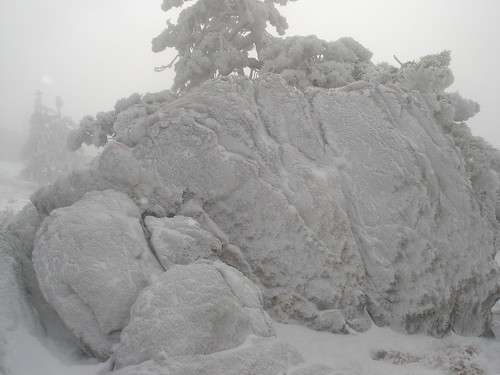
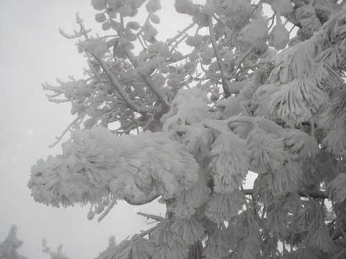
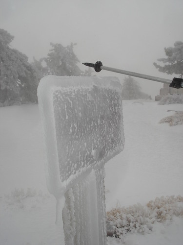
Re: 20080108 Icehouse Canyon
another nice Trip report and great photos.
You sound very technical,
An alluvial fan comprised of Rime Gravel
An excellent explanation,
Too bad for the Graffiti, idiots!!
You sound very technical,
An alluvial fan comprised of Rime Gravel
An excellent explanation,
Too bad for the Graffiti, idiots!!
- Mon Jan 07, 2008 9:19 pm
- Forum: Los Padres
- Topic: Sawmill Mnt, Burnt Peak, Sawtooth Mnt and Liebre Mnt.
- Replies: 9
- Views: 221
Re: Sawmill Mnt, Burnt Peak, Sawtooth Mnt and Liebre Mnt.
Wot's wrong with peak-bagging? Some people really need to get a life. There are some, although I don't think any on this board, who view peak bagging negatively. Their views are that peak bagging is akin to conquering peaks and climbing them for the wrong reasons. But I agree that I think peak bagg...
- Sun Jan 06, 2008 9:18 pm
- Forum: Los Padres
- Topic: Sawmill Mnt, Burnt Peak, Sawtooth Mnt and Liebre Mnt.
- Replies: 9
- Views: 221
Sawmill Mnt, Burnt Peak, Sawtooth Mnt and Liebre Mnt.
When on a quick hike with Augie and Tom today (1/6/8). It was wet, foggy and cold. No views at all. It snowed a bit too. But an enjoyable day peakbagging. Made it home by 2:30 pm so the wife was happy. Here are pictures, GPS tracks and Google Map. http://www.gpsmountaineering.com/burntp ... emountai...
- Tue Jan 01, 2008 4:25 pm
- Forum: San Gabriels
- Topic: Circle Mountain - my 100th HPS Peak
- Replies: 4
- Views: 85
Re: Circle Mountain - my 100th HPS Peak
I wrote a Trip Report. I appreciate any input and vote.
http://www.summitpost.org/trip-report/3 ... Peaks.html
thanks,
http://www.summitpost.org/trip-report/3 ... Peaks.html
thanks,
- Mon Dec 31, 2007 10:35 pm
- Forum: San Gabriels
- Topic: Circle Mountain - my 100th HPS Peak
- Replies: 4
- Views: 85
Circle Mountain - my 100th HPS Peak
Today I climbed my 100th Hundred Peak Section Peak with my family on an easy peak, Circle Mountain. It was a great hike and I managed to meet my goal of 100 peaks by the end of 2007. http://www.gpsmountaineering.com/circlemountain12-31-07 Here is a picture of my Daughter signing the summit register....
- Sat Dec 29, 2007 3:41 pm
- Forum: General Discussion
- Topic: San Gabriel Ice!
- Replies: 6
- Views: 133
Re: San Gabriel Ice!
Probably 1" thick, it looked real cool
- Sat Dec 29, 2007 11:51 am
- Forum: News & Conditions
- Topic: Death at Jackson Lake
- Replies: 2
- Views: 76
Re: Death at Jackson Lake
Crazy that people would go out on such thin ice! Accident waiting to happen.
- Sat Dec 29, 2007 11:47 am
- Forum: San Gabriels
- Topic: Trail & Condor canyon
- Replies: 10
- Views: 139
Re: Trail & Condor canyon
Sounds like a good adventure regardless, I figure the easiest route is probably along the ridge from Big Condor Mountain (but who wants easy?).
- Sat Dec 29, 2007 11:40 am
- Forum: General Discussion
- Topic: San Gabriel Ice!
- Replies: 6
- Views: 133
- Sat Dec 29, 2007 11:35 am
- Forum: Los Padres
- Topic: Ventura County and Kern County High Points
- Replies: 1
- Views: 77
Ventura County and Kern County High Points
You would think I was a high pointer or something, but I sware I did not know these were county highpoints prior to hiking them yesterday 12-28-07. Tom and I hiked 6 peaks in the Frazier Park Area north on the I5. Not that far away and a beautiful area. The highpoint of the hike (no pun intended) wa...
- Tue Dec 25, 2007 10:01 pm
- Forum: San Gabriels
- Topic: Mount Baden-Powell, Burnham, Throop Peak and Lewis
- Replies: 13
- Views: 246
Re: Mount Baden-Powell, Burnham, Throop Peak and Lewis
Yes, there is more mileage following the ACH, but once from Dawson Saddle it is down hill all the way, a lot less elevation gain.
I have been forgetting to download Geocaches to my GPS lately, usually I will check out any caches along the route. I see you do the same.
I have been forgetting to download Geocaches to my GPS lately, usually I will check out any caches along the route. I see you do the same.
- Tue Dec 25, 2007 9:57 pm
- Forum: General Discussion
- Topic: Chapman Mt or Timber Peak?
- Replies: 11
- Views: 203
Re: Chapman Mt or Timber Peak?
I enjoyed your video, sort of reminded me of Survivorman.
- Mon Dec 24, 2007 4:50 pm
- Forum: San Gabriels
- Topic: Mount Baden-Powell, Burnham, Throop Peak and Lewis
- Replies: 13
- Views: 246
Re: Mount Baden-Powell, Burnham, Throop Peak and Lewis
our route up to Baden-Powell involved following some snowborder tracks most of the way. The conditions were perfect, especially near the top. Lots of deep powder, it looks so awesome to snow board down. Take a look at this pic, showing the route through fresh powder that the snow boarder "carve...
- Mon Dec 24, 2007 4:02 pm
- Forum: San Gabriels
- Topic: Mount Baden-Powell, Burnham, Throop Peak and Lewis
- Replies: 13
- Views: 246
Re: Mount Baden-Powell, Burnham, Throop Peak and Lewis
I just tried myself and it worked fine. Maybe try saving to your computer first, then open in Google Earth from your computer.Rob wrote:Travis, I couldn't open your Baden-Powell KMZ file -- Google Earth gave me an error message. I'll try again later.
- Mon Dec 24, 2007 1:18 pm
- Forum: General Discussion
- Topic: Iron Mountain via southwest ridge
- Replies: 1
- Views: 63
Iron Mountain via southwest ridge
I read in the lookout (HPS Newsletter) a trip report on ascending Iron via the southwest ridge. I would like to try it. See below in blue. Basically we follow Allison gulch up to just before the waterfall and take a use trail to the west. Is it said to be in good condition. Follow it all the way to ...
- Mon Dec 24, 2007 8:39 am
- Forum: News & Conditions
- Topic: Angeles Crest Highway (CA-2)
- Replies: 639
- Views: 17408
Re: Angeles Crest Highway (CA-2)
We walked along the ACH from Dawson Saddle to Vincent Gap yesterday. The majority of the road has been repaved and there is working happening on 2 of the 3 washout sections. Hoever, the one MAJOR washout has no work going on and is going to need a bridge or something to fix. I am still positive and ...
- Mon Dec 24, 2007 8:33 am
- Forum: San Gabriels
- Topic: 20071223 Telegraph Peak West Ridge
- Replies: 8
- Views: 120
Re: 20071223 Telegraph Peak West Ridge
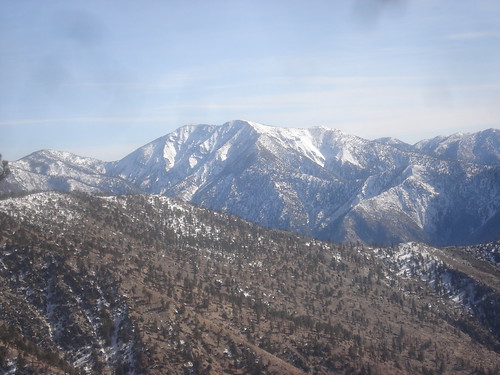
Tom and I were out hiking Baden-Powell, Brunham, Throop and Lewis. We figured you were in the mountains nearby somewhere. The views of Baldy were beautiful.
- Mon Dec 24, 2007 8:28 am
- Forum: San Gabriels
- Topic: Mount Baden-Powell, Burnham, Throop Peak and Lewis
- Replies: 13
- Views: 246
Mount Baden-Powell, Burnham, Throop Peak and Lewis
Tom and I went on a beautiful hike yesterday (12-23-07). We hiked up from Vincent Gap to Baden-Powell. The snow was not deep until the drifts near the top. It took us 2.5 hours to reach Baden in the snow. From there, we traversed the ridges to Burnham and then Throop. THe ridge traverse was fun, dee...
- Thu Dec 20, 2007 7:38 pm
- Forum: The Pub
- Topic: Happy Holidays
- Replies: 11
- Views: 240
Re: Happy Holidays
Merry Christmas and Happy New Year,
Hope to meet some of you on the trails in 2008.
Hope to meet some of you on the trails in 2008.
- Tue Dec 18, 2007 9:48 am
- Forum: California
- Topic: Orange County High Points - Santiago and Modjeska Peaks
- Replies: 4
- Views: 108
Re: Orange County High Points - Santiago and Modjeska Peaks
That looked like a great hike. I was just up there last month. I was thinking of doing Modjeska and Saddleback this month except Modjeska is just inside the fire closure area . I take it you didn't have any problems with rangers or JBTs? The road to the trailhead is really unbelievable. I didn't ev...
- Tue Dec 18, 2007 7:49 am
- Forum: California
- Topic: Orange County High Points - Santiago and Modjeska Peaks
- Replies: 4
- Views: 108
Orange County High Points - Santiago and Modjeska Peaks
Tom and I had a good hike in Orange County on Sunday, 12-16-07. Here are my GPS tracks, elevation profile and some photos. We climbed Santiago Peak and Modjeska Peaks, ascending via the Holy Jim Trail and descending the Joplin Trail.
http://www.gpsmountaineering.com/santia ... jeskapeaks
http://www.gpsmountaineering.com/santia ... jeskapeaks
- Mon Dec 17, 2007 1:21 pm
- Forum: Gear & Fitness
- Topic: How to upload data from GPS to PC
- Replies: 8
- Views: 179
Re: How to upload data from GPS to PC
What I have is the plain old black ad white eTrex Vista, which comes with a serial cable, not a USB. I thought this was ridiculous at first (see my snark in the first post in this thread), but I later realized (while hiking Icehouse Canyon) that these GPS units are designed to talk to devices other...
- Mon Dec 17, 2007 1:11 pm
- Forum: San Gabriels
- Topic: Mt Harwood Northeast Ridge, "Holtgrefe Ridge"
- Replies: 6
- Views: 119
Re: Mt Harwood Northeast Ridge, "Holtgrefe Ridge"
Great Trip Report an Route Page. Looks like you are really taking advantage of the snow, I am envious. Tom and I ended up slogging up Santiago Peak in Orange County.
- Fri Dec 07, 2007 7:18 am
- Forum: General Discussion
- Topic: Hoyt Mt.
- Replies: 3
- Views: 82
Re: Hoyt Mt.
Augie has a summitpost mountain page, I am not sure if it is what you are looking for, but his Route 1: East Ridge looks to me to start from Geroge's Gap.
http://www.summitpost.org/mountain/rock ... ntain.html
http://www.summitpost.org/mountain/rock ... ntain.html