Looking for Liebre

TRs for the San Gabriel Mountains.
Post Reply
User avatar
JeffH
Posts: 1143
Joined: Sun Nov 28, 2010 7:09 am

Post by JeffH »

I met up with Girl Hiker on Saturday, rain was in the forecast for afternoon so we thought the morning might be conducive to hike. My intent was to head up Mt Lukens since I've never been there and it's getting close to warm season when it is a less attractive walk. After a quick stop at McD we were on the road and discussing recent reports on this fine forum. Looking at the weather it seemed that Lukens might be covered in clouds, which is nice for hiking and not so nice for views. So I mentioned Tom's report about Liebre and how it mentioned all the wildflowers. It's also that season, and not having a big view is OK when local flora is the goal and photos wouldn't be washed out by the sunlight. I had recently looked to see exactly where Liebre is located and read a couple interweb trip reports - somehow Sawmill stuck in my head, so I plugged that into the map and calmly followed the directions. Well it was an interesting drive along a sometimes barely two-lane Lake Hughes Road which goes around the north side of our planned destination, since creeks are flowing we did get to stop and look at some waterfalls. Anyway, we finally reached Pine Canyon Road where we managed to find our way to the next Pine Canyon junction and finally the PCT crossing. It still didn't look like what I remembered reading but CC knew the spot and we headed south towards Mexico. It was getting windy and we had a couple places where some fine rain or heavy mist blew in our faces, although to the west we could see some blue skies on either side of the dark clouds. Upon reaching the Horse Campground I figured that was probably far enough since my hands were getting real cold and conditions would only be windier and wetter as we got higher on the mountain. So I found a spot behind some deadfall where I could start up the Jetboil and I whipped up some hot chocolate as part of a nice mid-morning snack. We hung out there for a little while, chatted with a couple of hikers on the way down - one guy said it's his favorite hike and that we probably had another couple hours before it would rain (wrong). Anyway this long story is to say that we never found the abundant fields of flowers that were promised, maybe because we took a different trail up? Still a good day to be out, if nothing else the green grasses and some other kind of oak trees made for a pleasant walk.


Pics:

Waterfall along the route.
DSC00074.JPG
Pacific Crest Trail
DSC00076.JPG
Blue skies ahead
IMG_2066.JPG
Still mixed looking west so maybe it will clear up......
DSC00082.JPG
Rare shady spot on the lower part of this trail
DSC00086.JPG
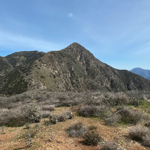
Stopping point for the day
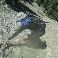
DSC00093.JPG
Leap of faith
IMG_2097b.jpg
"Argue for your limitations and sure enough they're yours".
Donald Shimoda
User avatar
Girl Hiker
Posts: 1288
Joined: Fri Apr 04, 2014 7:46 am

Post by Girl Hiker »

It was a nice hike regardless of the weather. I had fun and thanks for the delicious hot chocolate. Btw those Carolina Reapers were awesome!
IMG_20240413_102607.jpg
IMG_20240413_104247.jpg
IMG_20240413_104443.jpg
IMG_20240413_115633.jpg
IMG_20240413_115108.jpg
IMG_20240413_091353.jpg
IMG_20240413_105252~2.jpg
IMG_20240413_101618.jpg
User avatar
Tom Kenney
Posts: 343
Joined: Sat Sep 29, 2007 7:51 pm

Post by Tom Kenney »

Looks like a grand day out! I can see why random hiker had that preference.

Yeah, kinda the long route. HEHE!!! The good fields are the opposite, southwest, side of Liebre. I-5 -> CA-138 -> Old Ridge Route -> past Sandberg a few km to the start of 7N23. You can also park at Sandberg and take Golden Eagle Trail, but that puts you on the ridge above the fields. A loop can be done Golden Eagle->7N23, but you then have a short stretch of Old Ridge Route to hoof it back to the car. Two or more cars, or car and bike, and it's an easy shuttle. :)

Hitchhikers' Guide to the Galaxy advises to always bring a towel. "Always bring a stove!" is some interesting corollary.
User avatar
Girl Hiker
Posts: 1288
Joined: Fri Apr 04, 2014 7:46 am

Post by Girl Hiker »

I actually took the Sandburg trail in my last report. I'll have to check out the Eagle trail one day.
User avatar
Nate U
Posts: 211
Joined: Wed Apr 05, 2023 7:38 pm

Post by Nate U »

Nice, never hiked in the Lake Hughes area but looks like a good hike for a cloudy day.

Mt Lukens is on my to-do list as well. I want to come up the 'Kill 'em Quick' and follow the camel back ridge to the summit. Then probably go down one of the other trails for a point to point with quick car shuttle. Any interest?
User avatar
JeffH
Posts: 1143
Joined: Sun Nov 28, 2010 7:09 am

Post by JeffH »

Nate U wrote: Fri Apr 19, 2024 2:41 pm Nice, never hiked in the Lake Hughes area but looks like a good hike for a cloudy day.

Mt Lukens is on my to-do list as well. I want to come up the 'Kill 'em Quick' and follow the camel back ridge to the summit. Then probably go down one of the other trails for a point to point with quick car shuttle. Any interest?
I like the sound of it, would have to do it pretty soon before things get too warm. I'm only free on Saturdays now.
"Argue for your limitations and sure enough they're yours".
Donald Shimoda
User avatar
tekewin
Posts: 1182
Joined: Thu Apr 11, 2013 5:07 pm

Post by tekewin »

I hiked to Liebre Mountain exactly two years ago today. I had better weather than you. I found a few flowers, but there were somewhat underwhelming. You were on the right trail.
User avatar
Sean
Posts: 3700
Joined: Wed Jul 27, 2011 12:32 pm

Post by Sean »

Thanks for the report. Sometimes the best hikes are unplanned and decided on a whim. I like driving up the ACH with no particular goal in mind, then I'll get inspired to stop and explore a random area.
User avatar
Girl Hiker
Posts: 1288
Joined: Fri Apr 04, 2014 7:46 am

Post by Girl Hiker »

Me too.
Post Reply