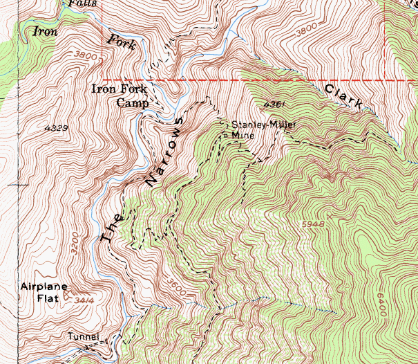
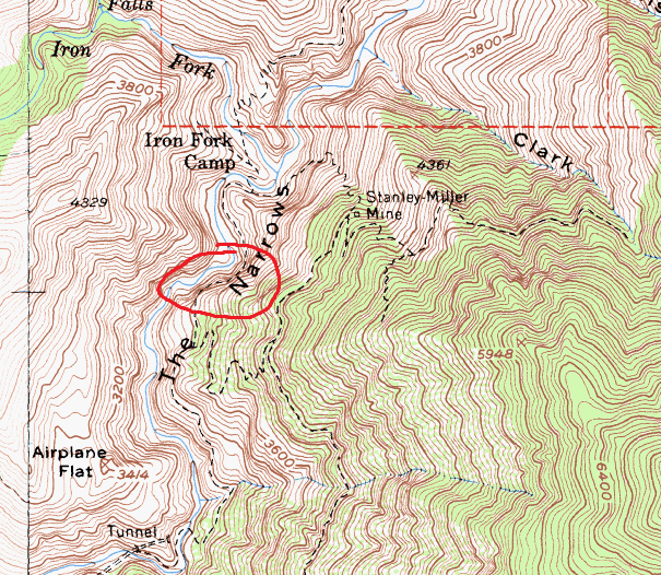
John Robinson, in his 'San Gabriels II' writes, "The airy Wetwater Trail, terror of the pack mules with its dripping water, was hacked out of the cliffs above the Narrows to gain access (to the Stanley-Miller mine)."
I remember reading in the 'Mines of the San Gabriels' (also written by Robinson) that the trail was some 600 feet above the narrows. It was also briefly mentioned in this report on the Stanley-Miller mine (https://www.summitpost.org/northwest-ri ... ine/622907).
There's also this photo from AllTrails. I wasn't able to find any other info on it.
Does anyone have more info on this trail? Is it still a passable route? Where does the trail go?
I would assume it's really exposed, is it even there anymore?
Maybe it's the trail just N/NW of the mine leading to it? It does seem to cross very high elevation gain as it exits the narrows? But the image you posted show what appear to be a trail elevating from left to right, which wouldn't make sense if it's the one I'm looking at. Unless the pic you posted is flipped. Very interesting.
I think I know what part of the Wetwater is in the pic:
Came to this conclusion from their Alltrails GPX (https://www.alltrails.com/explore/recor ... st-fork--2) You can see the image posted near the end of that recording showing where they took the pic. As for whether it's still there...probably ... just very unsafe to use i guess.