
General Conditions

-
Richard N.
- Posts: 91
- Joined: Tue Feb 12, 2008 9:47 pm
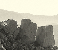
Icy Springs is about a mile or so down the dirt road from Vincent Gap towards Big Rock Campground. The trail & road both go by it.

Wouldnt worry about it, Iron Fork camp is a pretty sizable area. Just dont shortcut it to the East Fork or vice versa unless you really like brush and hell. At least 6 tents with space...close to confluence so more area there too(though non-fire area).
Could be hot,ants, and flies. Also -water filter. Its really a ho-hum area with the action elsewhere. Stay put latest in the day, leave as early kind of place.
Could be hot,ants, and flies. Also -water filter. Its really a ho-hum area with the action elsewhere. Stay put latest in the day, leave as early kind of place.
I would stay at Iron Fork if I required a fire(not sure on the legality of this but).I was only talking about the camp itself. There are places quite nearby to hangout. Iron Fork camp is not hard to get to, its just that one must enter/exit in the Iron Fork river...which is frustrating since you see the Iron Fork coming up(+ a stream crossing) and think maybe just hike up a hill and cut diagonally to the camp.....bad idea. It especially looks tempting from the camp since there is a use trail ,to add to the lure, towards the east fork.Zé wrote:thanks.
so maybe 20 person limit
how far away is it from the river? what do you mean 'don't shortcut it'...is it hard to get to from the water?
any other suggestions of where to camp, would fish fork camp be better?
If you snag Stanley-Miller, then go up to Fish Fork camp, then on return camp at Iron Fork, you'll be in a good position. Are you hitting up any other mines like Blue Jay mine?
The Stanely Miller I know about (I've been there), but where is the Blue Jay?
So, don't go to Iron Fork any other way than via the water course? So, is it really steep in between? Stinging nettles? Heavyduty bushwhack? The Iron Fork camp police take you away?
So, don't go to Iron Fork any other way than via the water course? So, is it really steep in between? Stinging nettles? Heavyduty bushwhack? The Iron Fork camp police take you away?
That Blue Jay one is on the gold mining website as 1 mile up Alder creek, which is near Fish Fork...thats a long ways to see what....
Yes, the watercourse....the culprit is yucca on trying to circumvent that...the top is steep and dense brush, but its a trap to come down the hill and have to go super-slow..its like whats next? a rattlesnake waiting?
The Iron Fork police is armed with heavy submachine guns but only patrols the scenic area(canyoneering route)..offenders are executed on the spot, no trial for graffiti, trash, or fire....not even allowed to eat...heck the rules are everything is packed out, including human waste.
So, it's either pack out your waste or get wasted?AW wrote:The Iron Fork police is armed with heavy submachine guns but only patrols the scenic area(canyoneering route)..offenders are executed on the spot, no trial for graffiti, trash, or fire....not even allowed to eat...heck the rules are everything is packed out, including human waste.
awesome, thanks a lot.should work out just fine then
forgot about the blue-jay, i'll have to look that up. of course, as long as i'm up there, might as well check it out!
although I'm starting to tack on probably too many exploratory goals for just a one-nighter!
forgot about the blue-jay, i'll have to look that up. of course, as long as i'm up there, might as well check it out!
although I'm starting to tack on probably too many exploratory goals for just a one-nighter!
Dude! Just turn your one-nighter into an all-nighter. It's going to be dark inside the mine anyway, right?Zé wrote:although I'm starting to tack on probably too many exploratory goals for just a one-nighter!
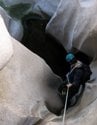
Seriously though, I found multiple shafts at the Stanley-Miller that were in good shape. Not at all like the Widco/Baldora Mine. More like Allison Mine. One of the lower shafts had a lot of old crushed cans -- I think a lot of them were fuel cans. Perhaps that shaft played out and they used it as a land fill, although the fact that they flattened them suggests that access to that shaft was still maintained. I seem to recall that there was a mine cart near the entrance to one of the shafts. Of the mines in the SG's that I've visited, this is the best preserved. It's so remote and difficult to get to that it's artifacts haven't been looted.
I didn't have much time to explore the time I was there due to fading daylight, so I'd love to see photos.
I wonder if that big old cast iron stove is still up there (of course I can't imagine someone would move it). Look for rock chimneys sticking up out of the brush. I was able to navigate into the vicinity with map and compass (and a bit of help from God* perhaps
Happy hunting!
HJ
*I did that trip with a 1:62,500 map which contains the data of four 1:24,000 maps on a smaller sheet of paper. I'd like to think I'm good with maps, but with a 1:62,500, finding a mine in the brush is something of a crapshoot, thus my suggestion that I had a little help.


Nice timing! My first weekend at home in about two months.
I guess I'll be cleaning the rain gutters tomorrow.
I guess I'll be cleaning the rain gutters tomorrow.
Nunc est bibendum
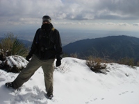
Having all the boxes checked for the highest peaks in LA San Bernardino & Orange counties. I have yet to even take one hike in ventura. I figure why not take on all 4 of it highest in one shot...Has any one been to this area lately?
I suspect it would be very warm and and early start would be mandatory.
I suspect it would be very warm and and early start would be mandatory.
Pardon my ignorance, but what are the four highest in Ventura County?
I've been up Pinos and Sawmill. Also Reyes and Haddock. Possibly Abel, but can't remember.
Good hiking out there. It can be hot, but Pinos is above 8k and stays a bit cooler.
I've been up Pinos and Sawmill. Also Reyes and Haddock. Possibly Abel, but can't remember.
Good hiking out there. It can be hot, but Pinos is above 8k and stays a bit cooler.
-
Terry Morse
- Posts: 126
- Joined: Mon Mar 03, 2008 8:55 pm
I've done the hike from Pinos to Abel & back twice in the last month. The trail is in excellent condition. Lots of up & downs on the way. There are ducks marking the use trails to both Sawmill & Grouse.
I figure it's about 13 miles RT. Temps were comfortable both times.....shorts & t-shirt weather.
I figure it's about 13 miles RT. Temps were comfortable both times.....shorts & t-shirt weather.
Sawmill Mountain is the highest point in Kern County and Grouse Mountain is on the border of Kern County and Ventura County, but the peak itself actually lies in Kern County. Cerro Noroeste is also in Kern County. It used to be called Mt Abel after some Kern County dude.
Either way, jsut climb all of them and you can check off the high points in Ventura County and Kern County.
edenooch - when you planning to knock the Ventura Peaks out?
I'm curious if you have a list; it'd be interesting to see. I know the top three for San Berdoo County: San Gorgonio Mountain (11,502'), Jepson (11,208'), and Bighorn (11,000'), but I've not thought about LA County, let alone OC.edenooch wrote:Having all the boxes checked for the highest peaks in LA San Bernardino & Orange counties.
I guess LA would be: Baldy, West Baldy, and Baden-Powell.
Just looked it up. I'm wrong. From peakbagger.com:
Major Peaks of the San Gabriel MountainsTen Highest PeaksRankPeak NameftmClimbed1.Mount San Antonio10,0643068jbb2.Pine Mountain96482941jbb3.Dawson Peak95752918jbb4.Mount Harwood95522911jbb5.Mount Baden-Powell93992865jbb6.Throop Peak91382785jbb7.Mount Burnham89972742jbb8.Telegraph Peak89852739jbb9.Cucamonga Peak88592700jbb10.Mount Hawkins88502697jbb
Major Peaks of the San Bernardino MountainsTen Highest PeaksRankPeak NameftmClimbed1.San Gorgonio Mountain11,4993505jbb2.Jepson Peak11,2053415jbb3.Bighorn Mountain10,9973352:(4.Dragons Head10,8663312:(5.Anderson Peak10,840+3304+jbb6.Charlton Peak10,8063294jbb7.Shields Peak10,680+3255+jbb8.San Bernardino Peak10,6493246jbb9.Alto Diablo10,5633220jbb10.Dobbs Peak East10,520+3206+
Major Peaks of the Peninsular Southern California RangesTen Highest PeaksRankPeak NameftmClimbed1.San Jacinto Peak10,8393304jbb2.Jean Peak10,6703252jbb3.Folly Peak10,480+3194+jbb4.Miller Peak10,400+3170+jbb5.Marion Mountain10,3623158jbb6.Newton Drury Peak10,160+3097+:(7.Cornell Peak97502972jbb8.Luella Todd Peak93562852:(9.Cienaga Peak91442787:(10.Tahquitz Peak88462696jbb
Major Peaks of the San Emigdio MountainsTen Highest PeaksRankPeak NameftmClimbed1.Mount Pinos88312692jbb2.Sawmill Mountain88182688 jbb3.Sawmill Mountain-West Peak87492667:(4.Grouse Mountain85822616:(5.Cerro Noroeste8280+2524+:(6.Frazier Mountain8000+2438+:(7.San Emigdio Mountain74922284:(8.Tecuya Mountain7160+2182+:(9.Brush Mountain70482148:(10.Antimony Peak68482087:(
Major Peaks of the Ventura RangesTen Highest PeaksRankPeak NameftmClimbed1.Reyes Peak75142290jbb2.Haddock Mountain74312265jbb3.Alamo Mountain73672245:(4.Thorn Point6920+2109+:(5.McDonald Peak68702094:(6.Sewart Mountain68412085:(7.Cobblestone Mountain67332052:(8.Hines Peak67162047:(9.San Rafael Peak6640+2024+:(10.San Guillermo Mountain66062014:(Child Range High PointsRankPeak NameftmClimbed1.Reyes Peak75142290jbb2.Alamo Mountain73672245:(3.Hines Peak67162047:(4.Monte Arido60101832:(5.Cuyama Peak5880+1792+:(6.Oat Mountain37471142:(7.Simi Peak2403732:(
Yeah, I noticed that. And why isn't E SB Peak (10,691) on the list? It's higher than SB Peak (by about 20'). I shot him an email yesterday.Rumpled wrote:How come West baldy at 9988 didn't make the list?
Is it just a secondary peak or something?
He does say on the website that he knows there are some errors. In most cases, he enters in raw data and then a computer program generates the tables, lists, etc.
He replied as follows:
I haven't asked him about West Baldy (yet), but it is on his website as a sub-peak of Baldy. I don't quite understand his criteria. He lists "wannabe" peaks like Miller and Alto Diablo, but he doesn't list West Baldy. What gives?Hi, Jim,
I took a look at the USGS map and it appears that the official name is "San Bernardino East Peak". Since it is higher than "San Bernardino Peak", it is not a subpeak--you are right, in fact, one might consider the western peak to be a subpeak of the eastern one.
I have updated the name and subpeak status for the east peak:
http://www.peakbagger.com/peak.aspx?pid=1410
For now, I am not calling either one a subpeak, since they both have official names. They both have very low prominence, so they might both be considered subpeaks. But the one at the end of the ridge probably looks the most impressive from the valley, so it got the best name.
Thanks for pointing this out to me--appreciate the help.
--Greg
Webmaster, Peakbagger.com
Good to meet you out on the trail yesterday, bro.edenooch wrote:Having all the boxes checked for the highest peaks in LA San Bernardino & Orange counties. I have yet to even take one hike in ventura. I figure why not take on all 4 of it highest in one shot...Has any one been to this area lately?
I suspect it would be very warm and and early start would be mandatory.