
Well, I did get to see them closer as they were passing me by, thats how I found out what they were and I wanted be behind the wheel enjoying the crest ride, but then how often do you see them on the crest, it was a sudden surprise! By the time I realized I should have taken a closer shot they were gone!!! I think they were probably hanging out at Newcomb's Ranch Rest. On my way home I noticed a few other classics on the 210 HWY... I am in the process at getting a dslr, its lot of work for me to get the workings of them and another obstacle is the 1g you have to fork out....
Anyway, everyday so nice of you to really appreciate the pic and I am sure you wouldn't have minded taking one of the cobras for a ride on the crest!!!.....666
Angeles Crest Highway (CA-2)
Hey all,
I was hoping to connect Acorn Trail to Dawson's Saddle but from my understanding Hwy 2 is closed from Vincent Gap to Islip Saddle. I need to know if vehicles can access Vincent Gap from the east side of the San Gabriels so I can arrange a shuttle system. Any information regarding accessibility in terms of the Hwy 2 would greatly be appreciated! Thank you.
I was hoping to connect Acorn Trail to Dawson's Saddle but from my understanding Hwy 2 is closed from Vincent Gap to Islip Saddle. I need to know if vehicles can access Vincent Gap from the east side of the San Gabriels so I can arrange a shuttle system. Any information regarding accessibility in terms of the Hwy 2 would greatly be appreciated! Thank you.
I was at Vincent Gap the other day and came from Wrightwood. And yes its closed after that.nano wrote: ↑Hey all,
I was hoping to connect Acorn Trail to Dawson's Saddle but from my understanding Hwy 2 is closed from Vincent Gap to Islip Saddle. I need to know if vehicles can access Vincent Gap from the east side of the San Gabriels so I can arrange a shuttle system. Any information regarding accessibility in terms of the Hwy 2 would greatly be appreciated! Thank you.
-
cougarmagic

- Posts: 1409
- Joined: Wed May 07, 2008 5:21 pm
STATE ROUTE 2 WINTER CLOSURE SECTION REOPENS TODAY
San Bernardino County - Caltrans District 8 is reopening the closed
section of State Route 2 (SR 2) between Vincents Gap and Islip
Saddle today at 1:30 p.m. The route was closed for winter on
December 12, 2011. This is the first time that maintenance
employees can remember the route ever opening this early during
winter. The stretch of mountain highway, located west of Wrightwood
leading to Los Angeles County, typically closes every winter due to
heavy snow, avalanche activity, and concern for motorist safety and
does not reopen until Memorial Day.
Due to a low level of snow fall to date this winter, Maintenance
crews were able to clear the route of debris, clean the drainage
facilities, and prepare the roadway for opening to the traveling
public and sightseeing enthusiasts.
Motorists are advised that the route is subject to closure in the
event of heavy snow fall, storms, or other unforeseen events.
For more roadwork information please visit IE511.org.

-
cougarmagic
- Posts: 1409
- Joined: Wed May 07, 2008 5:21 pm
-
666-The Beast
- Posts: 124
- Joined: Wed Jun 15, 2011 8:08 pm
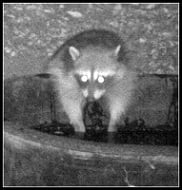
lilbitmo, normal people look like that when they see the kitty on the monitor and then decide to not to even go out of the house.
Meanwhile, any plans for a forest excursion are cancelled. It has affected CM also, she now sports the new terrifying kat look and she is too shy to let us see the rest her face.
I want to see CM capture her facial expression when she is all alone in the forest and sees the kitty !!!':shock:'
With the road open, its a good time to drive up the crest to BP and Ross.... waiting for the white..... 666
-
mcphersonm80
- Posts: 243
- Joined: Mon Aug 23, 2010 11:46 am
Pretty sure you won't have a problem. Wasn't much snow, and the road is still open all the way through, anyway. Doubt they even had to plow...
This highway information is the latest reported as of Tuesday, January 24, 2012 at 11:04 .
SR 2
[IN THE SOUTHERN CALIFORNIA AREA]
CHAINS OR SNOW TIRES ARE REQUIRED FROM 6 MI WEST OF NEWCOMB'S RANCH TO
ISLIP SADDLE (LOS ANGELES CO)
ALL TRACTOR-SEMI TRAILER COMBINATIONS WITH 3 AXLES OR GREATER ARE
PROHIBITED FROM THE JCT OF I 210 /IN LA CANADA-FLINTRIDGE/ TO THE
ANGELES FOREST HIGHWAY (LOS ANGELES CO) - ALTERNATE ROUTES ARE AVAILABLE
http://www.dot.ca.gov/cgi-bin/roads.cgi

Heads up on The Crest -
This weekend the 27th Annual Angeles Crest 100 Mile Endurance Run takes place. Travel safe everyone. Race starts in Wrightwood Saturday August 2rd / 5AM. Ends in Altadena Sunday at 2PM. Runner's will be crossing the AC at Inspiration Point, Islip Saddle, Vincent Gap, Kratka Ridge (above Eagles Roost). From Eagles Roost to Buckhorn exit runners are forced to run on side of road (endangered frog). Crossings at Parjarito, Glenwood Camp, and finally Shortcut Saddle. For map of course click race book link / scroll to page 12..
There will be extra cars up there this weekend as crews are going to Isp Point, Islip, Vincent, Eagles, and Shortcut to support. Runner crossings will not be an issue on Sunday. http://www.ac100.com/2014info/2014-racebook2.pdf
-
VermillionPearlGirl
- Posts: 239
- Joined: Wed Apr 06, 2011 9:57 am
Thanks for the heads up! That's actually really good to know.
And seriously, these people, crazy amazing.
And seriously, these people, crazy amazing.
I ran up to the Idlehour station to see the first runners go by around 9-10 PM. Last year the station peeps sighted a bear about 20 yards away next to the campground.
The funniest thing happened about 9:30 PM. A few kids hiked almost to Mt. Wilson, and turned around. They weren't sure about the route as it was the first time for all of them. A bit scared, they were jogging down. They had no idea a race was going on. As they made it toward the Idlehour trail and turned the corner, they "saw lights in the middle of the forest"
Well, everyone at the station saw the flashlights, and heard the jogging, and figured it was a runner.... Suddenly the 20 station people "in the middle of the forest" were cheering, clapping, and taking pictures. The runners looked REAL CONFUSED!! "What, did we win something?" "What's going on?" A momentary silence....... then everyone started laughing. Someone has pictures of it somewhere......
Here is a video from a quadcopter at the 2014 Newcomb Saddle Aid Station:
Newcomb Saddle Aid Station
Newcomb Saddle Aid Station
Great video Mike! It was good to meet you in person and shake your hand up at Newcombs Saddle. Once again I timed out at Idle Hour. The course is relentless!
ITB issues and blisters were my downfall. I couldn't muster the mental strength to press on through the pain.
Thanks for the support out there. Your aid station is great. I'm signed up for 2015.
Happy Trails!
ITB issues and blisters were my downfall. I couldn't muster the mental strength to press on through the pain.
Thanks for the support out there. Your aid station is great. I'm signed up for 2015.
Happy Trails!
Hey, shreddy! I was bummed to see your name out at Idlehour. It was certainly an honor to meet you up at Newcomb. That's tough to have an IT band issue so early in the race!
The video was from Gerry, one of the radio guys who brings his quadcopter for a little filming.
We'll see you next year if not before!
The video was from Gerry, one of the radio guys who brings his quadcopter for a little filming.
We'll see you next year if not before!
MikeP, thanks for the wonderful aerial footage.
In my experience, trail "running" uphill is much like hiking uphill, generally a sufferfest. But on a neutral or slightly downhill single track that is neither aerobically taxing nor overly technical, trail running can provide a joy entirely distinct from hiking -- the sweep of the terrain as you move through it at pace, with little or no weight to burden your back or slow your progress. The wide, flowing views in your final segment strongly evoke that sensation.
On the other hand, I'd imagine that 70 miles in to a 100 mile race, such sensations would be hard to come by!
Great story, Fortified... and even better to hear that the youngsters weren't running away from setting a fire or a hazing incident gone bad or showed up with back packs rattling with the sounds of spray paint cans in themfortified wrote: ↑I ran up to the Idlehour station to see the first runners go by around 9-10 PM. Last year the station peeps sighted a bear about 20 yards away next to the campground.
The funniest thing happened about 9:30 PM. A few kids hiked almost to Mt. Wilson, and turned around. They weren't sure about the route as it was the first time for all of them. A bit scared, they were jogging down. They had no idea a race was going on. As they made it toward the Idlehour trail and turned the corner, they "saw lights in the middle of the forest"
Well, everyone at the station saw the flashlights, and heard the jogging, and figured it was a runner.... Suddenly the 20 station people "in the middle of the forest" were cheering, clapping, and taking pictures. The runners looked REAL CONFUSED!! "What, did we win something?" "What's going on?" A momentary silence....... then everyone started laughing. Someone has pictures of it somewhere......
And yes Mike P - ditto the thanks for the aerial footage - it's nice to be a hawk without being a hawk --- who knows though, maybe it's not too bad being a hawk...
"Shreddy, congrats on another fine attempt!
I'm in awe of all who even start the race. Maybe someday..."
Much appreciated Turtle. AC100 3 Shreddy 0
I want to finish this thing!
The volunteers are amazing and this fine race tradition can't take place without them -
I'm in awe of all who even start the race. Maybe someday..."
Much appreciated Turtle. AC100 3 Shreddy 0
I want to finish this thing!
The volunteers are amazing and this fine race tradition can't take place without them -

-
atomicoyote

- Posts: 173
- Joined: Fri Dec 24, 2010 2:16 pm
That's the same thing I thought after watching the video, especially since the nails were all found on/in the same curve. Probably a dumba$$ roofing contractor not securing all his materials (those are nails for securing roof shingle panels).

This Weekend Aug 1 the 28th Annual Angeles Crest 100 Mile Endurance Run takes place. Roughly 170 runners will start. Race starts in Wrightwood Saturday Aug 1 / 5AM. Ends in Altadena / Loma Alta Park at 2PM Sunday. Saturday - Runners will be crossing Hwy 2 at Inspiration Point, Islip, Vincent Gap. Crossing after Mt Williamson to PCT, Eagles Roost. Runners will be on the road between Eagles Roost and Buckhorn due to endangered frog in Cooper Canyon. Crossings at Parjarito, Glenwood Camp and finally Shortcut Saddle.
There will be extra cars up there this weekend as crews are going to Ins. Point, Islip, Eagles , Shortcut to support. Run will not impact the Crest on Sunday.
Drive safely (always) and good luck to the runners!
There will be extra cars up there this weekend as crews are going to Ins. Point, Islip, Eagles , Shortcut to support. Run will not impact the Crest on Sunday.
Drive safely (always) and good luck to the runners!