
Went up from Sisar Road towards Hines Peak. Turned around at about 5600' give or take because...I'm dumb...and did not realize just how much snow would be up there. The sad answer: a WHOLE lot of snow.
However, the hike was beautiful and we took the long way (road) down to make it about 19.5 miles long. No summit, but the day was good. TONS of bear prints too. Is that common for this area, mainly on the Red Reef trail within a mile of White Ledge Camp.
TR is at my blog http://pasadenahiker.wordpress.com/2011 ... nyon-fail/
2.23.11 Hines Peak - summit FAIL, fun hike WIN
that was a stout objective! glad you saw the beauty of the Sespe. the hike to Hines Peak is a long one. just getting to Topatopa Bluff and back via Sisar Road is a long day. i still would like to do the drive up (or at least drive near version) where you can tag Topatopa, Hines and Chief all in the same day. i can still see snow on the Topatopa's from my house and MORE is coming. I heard the level on this storm fri/sat could be as low as 1000'. i livel at 900', WooHoo! i might get to play in snow just up the street where the elevation goes over 1k. 
in 2009 i hiked in snow on Pine Mtn Rd to Haddock Mtn and it was the best day of animal tracking i have ever seen. it was like every woodland animal had been out that morning just before we passed and made the hike so interesting. to answer your question... YES bear tracks are VERY common as are cougar tracks. i have seen both bear and cougar tracks at White Ledge. the Sespe is teeming with wildlife since there is so little encroachment from man. i recently told Hikin' Jim i would look for my pix from when we hiked up Santa Paula Creek all the way to the saddle north of Santa Paula Peak (forgot to download them from my memory card which i hope i still have.) on that day the track we saw more than any other was bear. they literally were everywhere and plenty at the saddle where the three of us took a nap. i have never had the opportunity to actually see a bear yet in the Sespe, but all of my Ventura County hiking buds have.
btw... did you notice that you may park past the water tank on the right just before the first water crossing? i thought it was Sisar Road, but i saw you mentioned Topa Road. gotta take a look at my map. also, is there a way to view your pix on your blog as a slideshow?

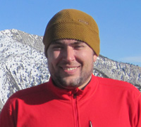
Hey Norma!
I didn't know if one could park near the water tank or not. We thought we'd play it safe and park in the neighborhood of 150 (the block next to the general store). Next time, though, parking at the water tank sounds like a dandy idea.
It felt really good to be out in the Sespe again yesterday! I hadn't been out there in a year and a half, basically since I had a pretty bad accident in Rose Valley/Piedra Blanca. What other hikes out that way would you recommend?
And I definitely can't wait for this weekend's more snow. I finally may have my excuse to buy some crampons
"Only" 19.5 miles? C'mon ya wuss, what's up with that? Wink
Fail is such a strong word. Sounds like a great hike to me.
HJ
Haha, this is true, Jim. I think I have some peak-bagging tendencies and if I don't get to the top, it can feel like "fail." But you're right... it was a great hike and a whole lot of fun!

-
cougarmagic

- Posts: 1409
- Joined: Wed May 07, 2008 5:21 pm
Very cool! I was only up that trail once, way back in...2004? New Year's eve. We didn't make it to any summit either, because of weather. But it was still fun.
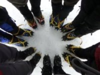
The photo with your foot, and the strange tracks with 'spikes' going off to the sides - I believe those are tracks of a longer haired dog, who has accumulated little balls of ice on the fur around his feet.
(to anyone with hiking dogs - this can be painful to your dog, and prevented with Musher's wax)
-
cougarmagic
- Posts: 1409
- Joined: Wed May 07, 2008 5:21 pm
